This Park is different from any other in the nation, a place where epiphany has some hope of lasting and not disappearing on one’s return to the workaday world. Here epiphany and routine commingle, balance rules, and human history makes a dent in the landscape, but not a hole.
Bill McKibben
Background
It was probably close to two years ago that I started thinking about taking a backpacking trip in the Adirondacks with my kids. I had been hiking more since the pandemic, and backpacking – hiking all day and camping overnight in the backcountry – seemed like a way to augment and optimize my hiking, extending it over multiple days. More than that though, I was inspired by my kids, who for years had been spending summers in the Adirondacks at Camp Treetops, developing a deep love for the Adirondack mountains and wilderness. Ceci had become an Adirondack Forty-Sixer at age 14, during her last year at summer camp; and Toby was also working his way through the ADK 46, hoping to finish before he aged out of camp.
So I began exploring how to get into backpacking, wanting to be sure I had adequate skills before going out into the backcountry with my kids. I knew my kids were skilled and experienced, but as the dad and grownup, I wanted to ensure my skills were at least somewhat commensurate with theirs. My years as a Boy Scout when I was significantly younger than they were underwhelming and virtually useless in this regard (glorified “car camping”, as I recall); and I hadn’t slept in a tent in close to five decades.
There are innumerable ways to learn to backpack – books, videos, courses, online and in-person, trial and error, etc. – but among the backpacking cognoscenti, as it were, all roads seem to lead to Andrew Skurka, whom I contacted late in 2021, and with whom I eventually did a trip in the Olympic National Park (guided by ultra-marathoner, trail runner, and FKT legend Joe ‘Stringbean’ McConaughy, and Nicco Tyson, a gifted musician who took his guitar on the trail). That trip took place in September 2022, but the preparation (Andrew’s coursework) was transformative. I did a great shakedown trip in the Catskills with Toby at the beginning of September, 2022 and, following the Olympic trip, a solo (short, and virtually impromptu) trip back in the Catskills.
But a year ago I was still only day-hiking. So when we took Ceci up to the Adirondacks last June (2022) to start her summer counseling job at Camp Treetops, she, Toby, and I included some day hiking, partly to help advance Toby’s 46 quest, and partly to get me started on Adirondack hiking. We only hiked Porter and Esther during that trip, but for me it was a great intro.
Planning
Following last year’s ADK trip, we knew we would return this June to do some backpacking. But we didn’t yet know what peaks we would target, as Toby hoped to complete his 46 last summer, his last year at camp. He summited at least 20 more ADK 46-ers last summer, but came up short by four peaks: Seymour, Sawteeth, Table Top, and Colden. Seymour is in the Seward Range in the Western High Peaks; Sawteeth, Table Top, and Colden in the Eastern High Peaks. So we already knew we would have to hike Seymour as a day hike, as it was too far from the others to link it in a continuous, multi-day trip.
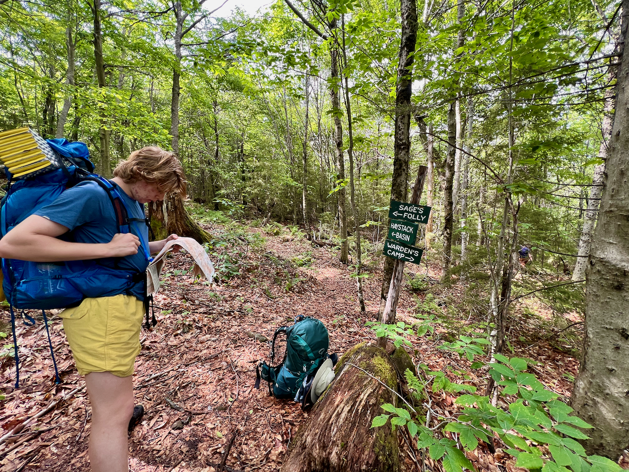
The Sawteeth and Colden mountains each have a couple of approaches to their summits, but Toby (conferring with Ceci who of course had hiked all these peaks) determined there really was only one way to link all three peaks, and he came up with a three-day, two-night route:
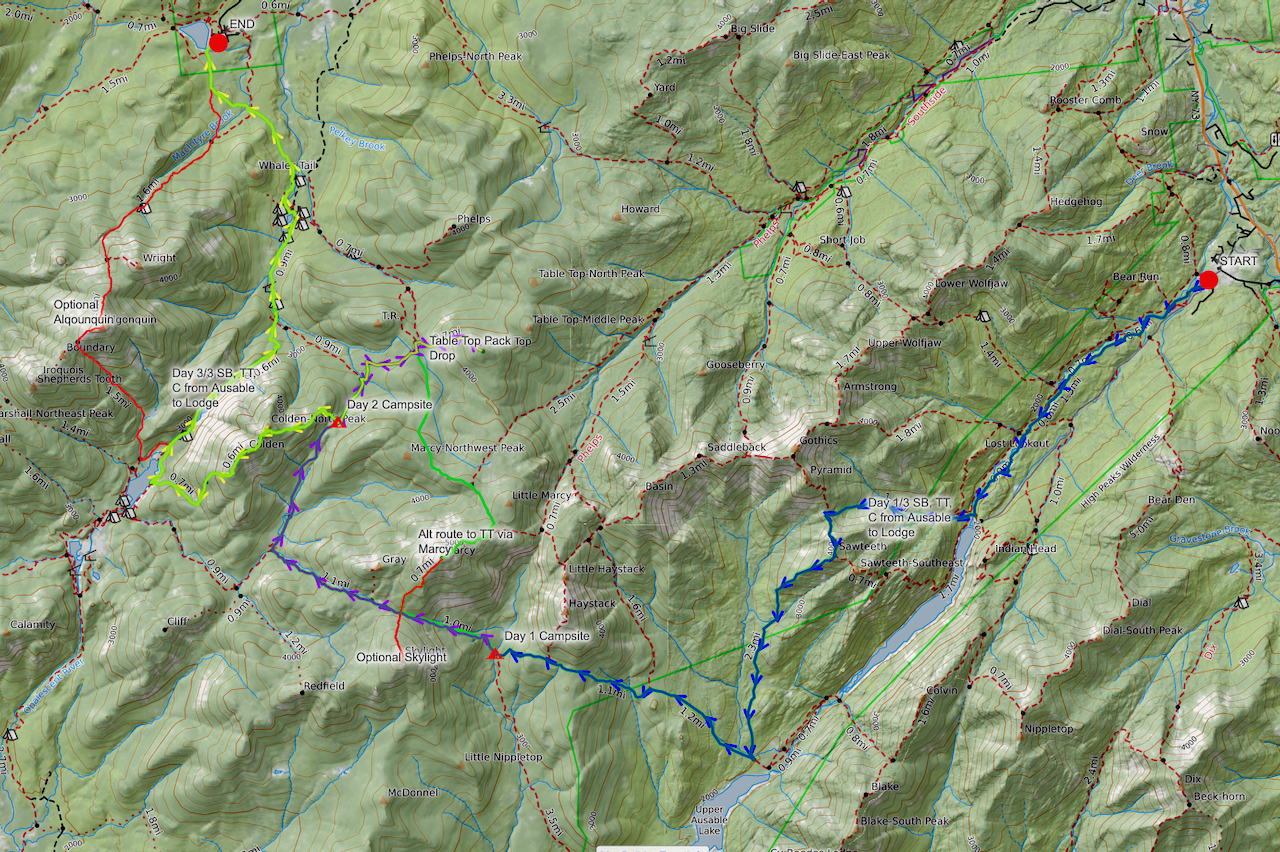
So a plan was formed: we would travel to the Adirondacks from Brooklyn after work; stay over somewhere, likely an AirBnB; then hike Seymour as an out-and-back day hike; return to our AirBnB; then commence our three-day backpacking trip (a “double overnight” in my kids’ camp parlance). We would also coordinate the trip with the start of Ceci’s camp job. Toby’s route however was a point-to-point route, so we would need to leave our car at the finish, and arrange a ride/shuttle to the start. Our trip would start at the AMR (Adirondacks Mountain Reserve) on Ausable Club land in St. Huberts, and conclude at the Adirdondack Loj, the gateway to the High Peaks Wilderness.
I contacted The Mountaineer, an extraordinary outdoor gear store in Keene Valley, NY for help and/or advice on a shuttle. The store is known for its experienced, knowledgeable, and passionate staff, but still, I was surprised when Mark reached out to me, offering to shuttle us early Sunday morning. I paid him – but still: shuttling unknown hikers and their gear at 7:00am on a Sunday morning is not something I think I’d want to do. I remain grateful to him, and was psyched when we finally met and I got to learn about his own outdoors pursuits (and he offered Ceci a good recommendation on a local climbing wall).
Synopsis*
Day 1, Saturday, June 17
Seymour: 16.4 miles hiked / 3,044 vertical feet gained
Day 2, Sunday, June 18
Sawteeth: 12.32 miles hiked / 4,865 vertical feet gained
Day 3, Monday, June 19
Skylight and Table Top: 10.4 miles hiked / 4,695 vertical feet gained
Day 4, Tuesday, June 20
Colden: 7.9 miles hiked / 1,686 vertical feet gained
Total miles: 47.02
Total vert: 14,290
*NOTE: mileages and elevation metrics come from a combination of recordings from my Garmin watch and/or Garmin InReach. I messed up recordings on both devices at various times, so needed to combine sources to get these metrics. This data likely diverges from the mileage and elevation metrics denoted in the CalTopo map. But despite possible (small) errors, I believe the metrics are fairly faithful, so I’m going with them.
Also note that I don’t include vertical feet lost (on descents) – in some respects climbing down is more arduous and challenging than climbing up. It’s probably safe to say that the average elevation change (up or down) per mile throughout the trip was close to 600 feet.
Preparation and Gear
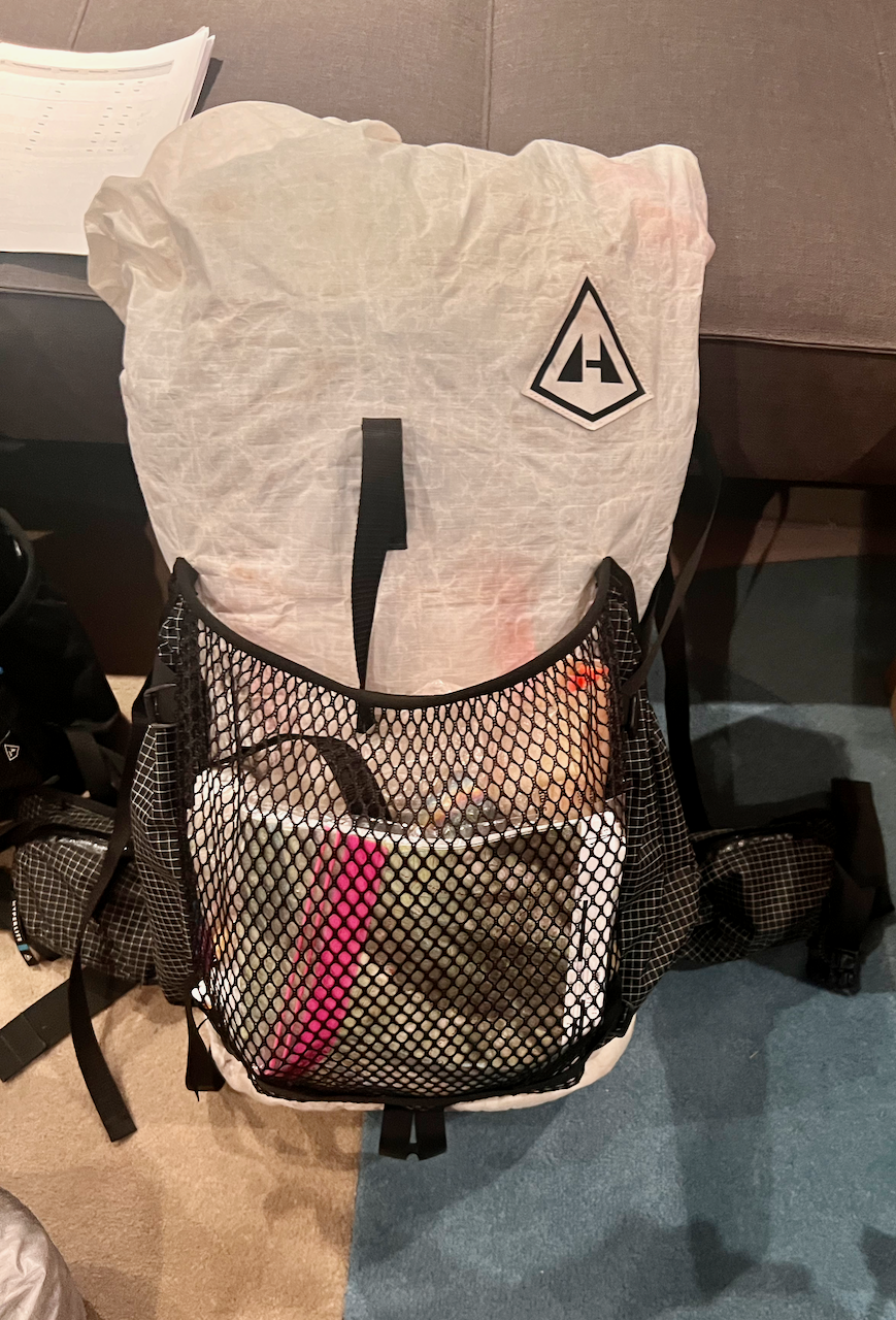
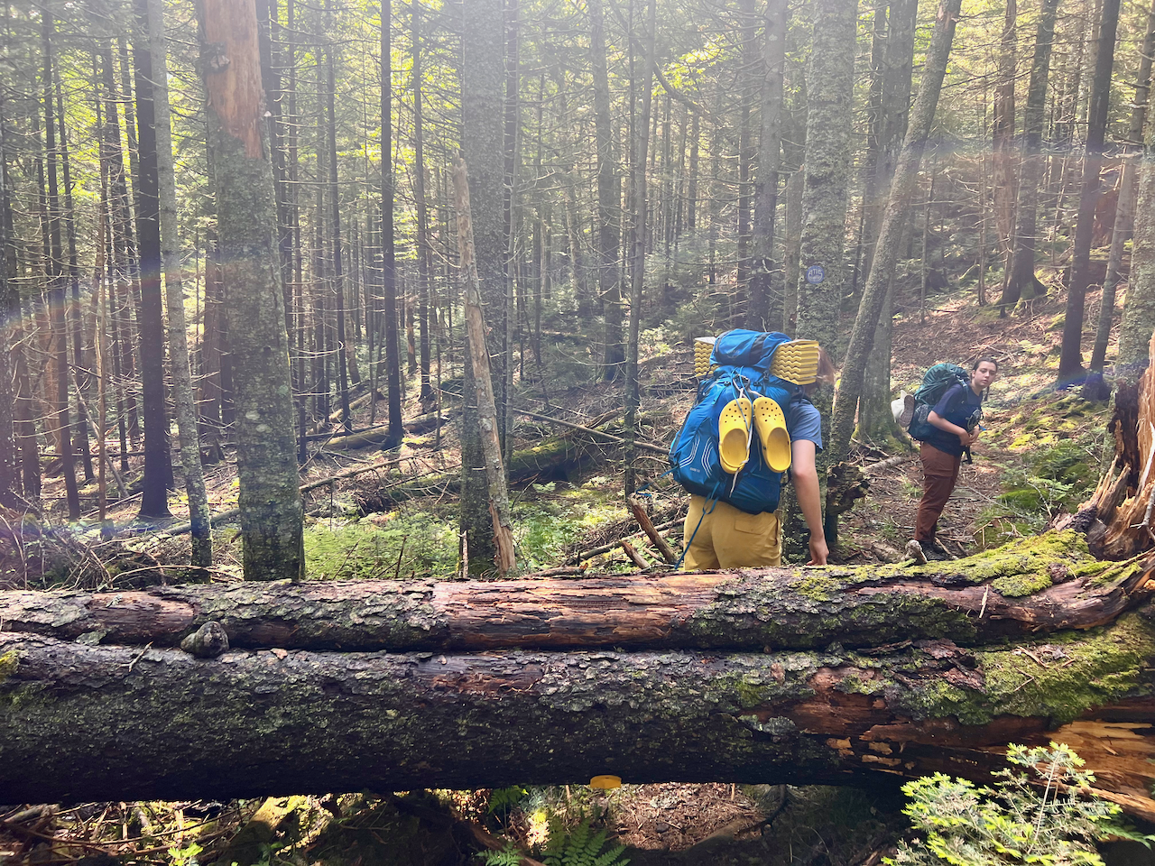
As my kids know, I could spend an entire post diving into gear, which after all is critical to the success and enjoyment of any hiking or backpacking trip. My kids of course have significant experience backpacking in the High Peaks Wilderness, but they still needed some items. Some gear choices worked; some didn’t. For example, we needed a second tent to accommodate the three of us and, given my success with the Durston X-Mid Pro 2 two-person tent (very light, easy to pitch, and roomy for two people and gear), I decided to buy another. But the X-Mid Pro 2 has a large footprint (100” x 80”), and it turns out the tent sites in the Adirondacks (at least where we pitched at Lake Arnold) are generally a bit small, cramped, and overgrown (and muddy).
Ceci pushed for a cook tarp, which she had used on group trips in the Adirondacks, where weather is famously unpredictable and wet, so with her help, we picked up a Kammock Kuhli tarp, at 13 ounces a nice lightweight addition (and yet we never used it!).
I once again used Andrew Skurka’s backpacking gear list template, which I had used for my trip with him and all my other trips. My gear list is here. I also have a LighterPack (a more visual gear list presentation format preferred by some backpackers) list here. My base weight is not “ultralight” (10 lbs or less), but instead “lightweight”, at 13.67 pounds, which along with water and food was comfortable to carry over most of the miles and climbs using my internally-framed pack.
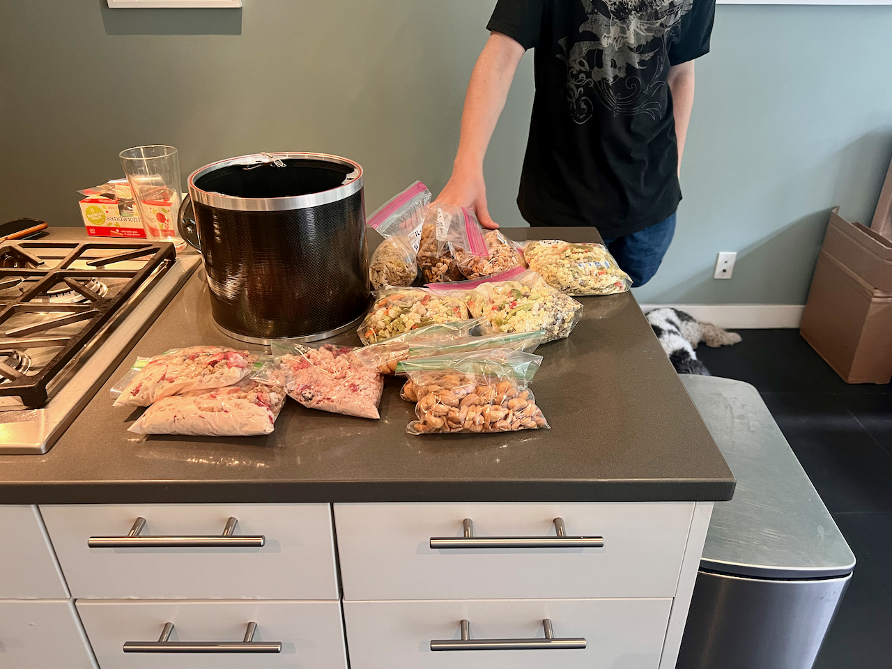
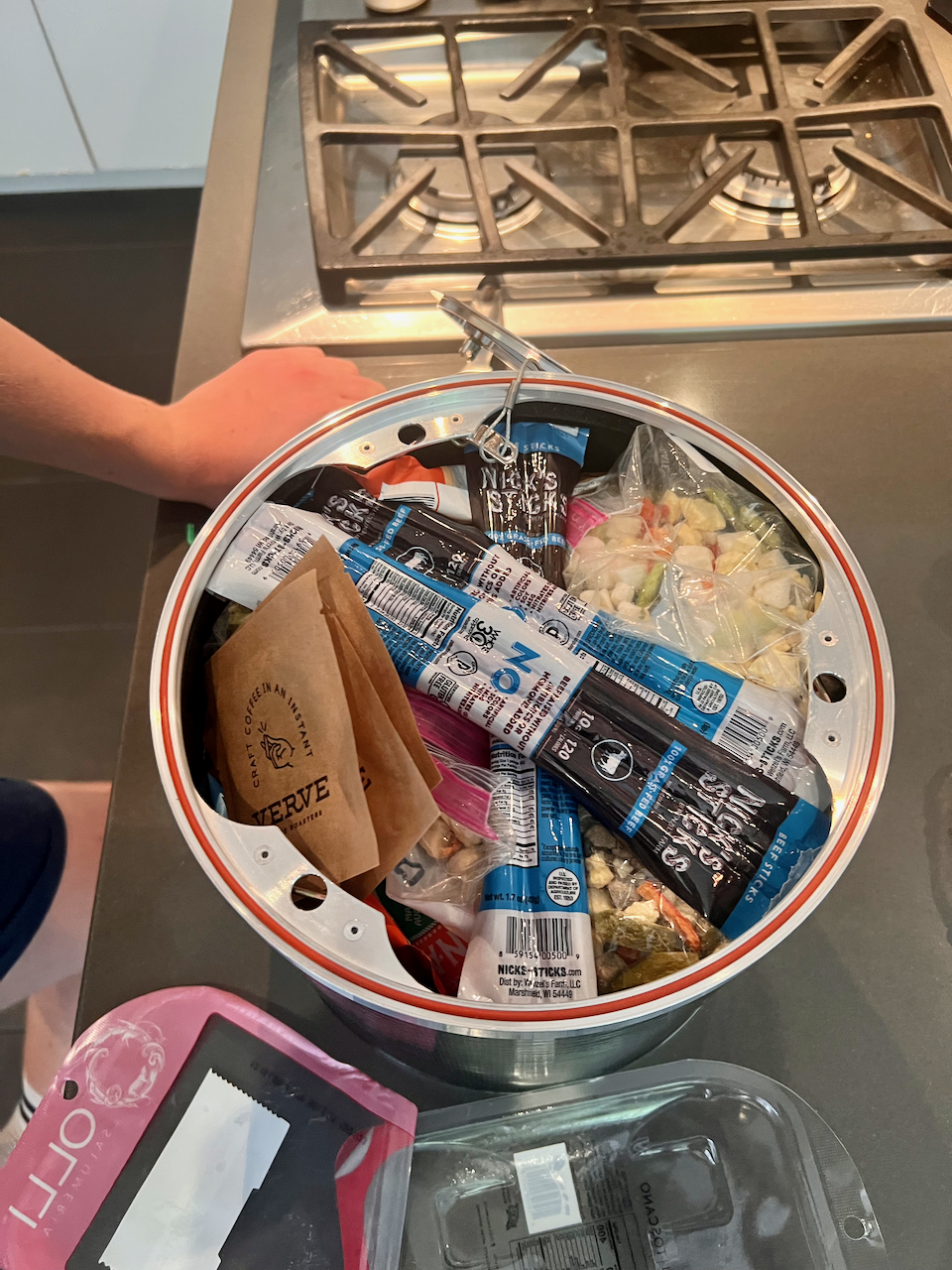
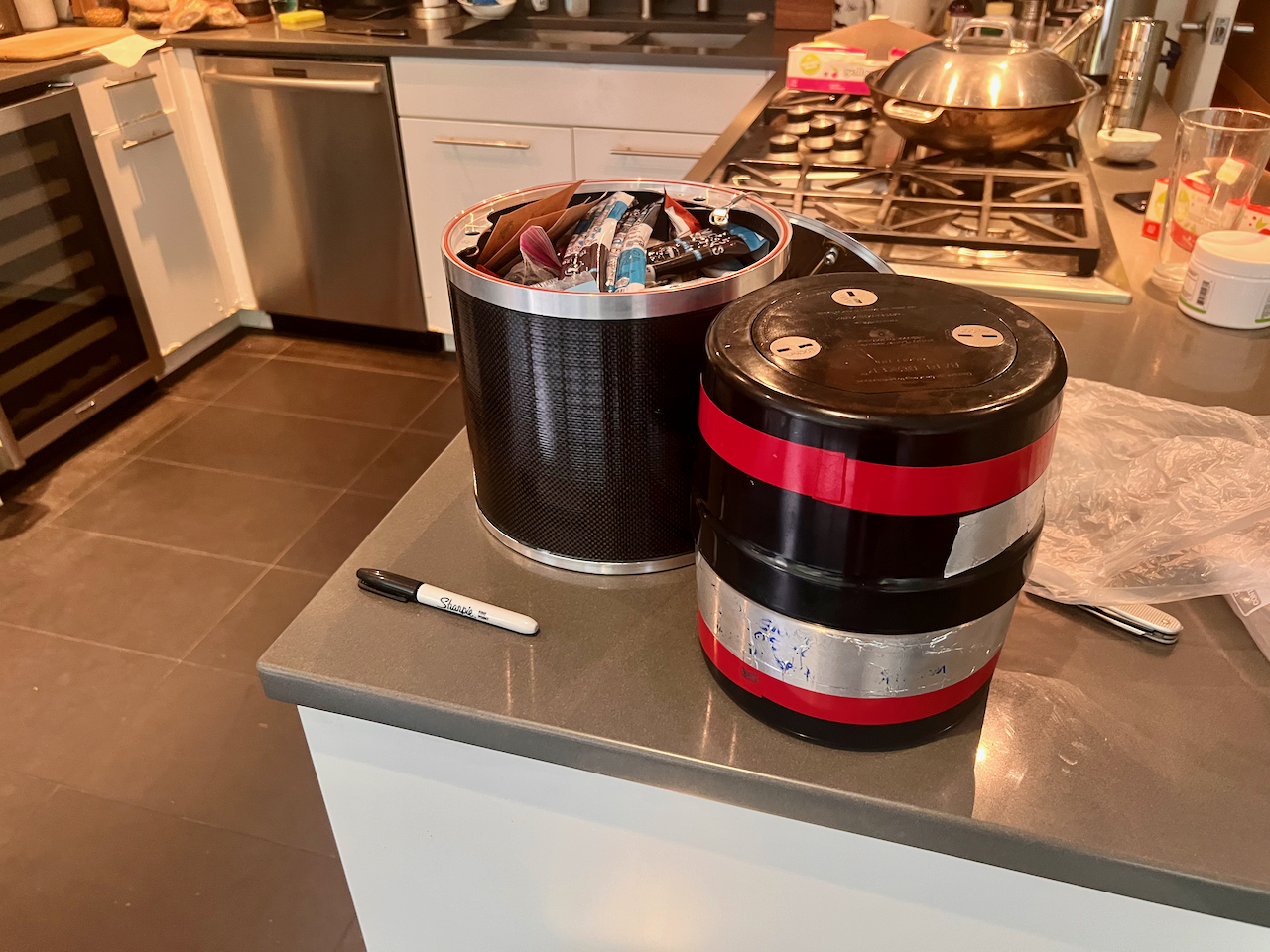
Speaking of food, Toby helped considerably re-packaging and packing freeze-dried meals, and organizing all our meals and snacks for three days on the trail, all of which (save for our first day on the trail) needed to fit into the two bear cans (required food protection in the High Peaks) that we used:
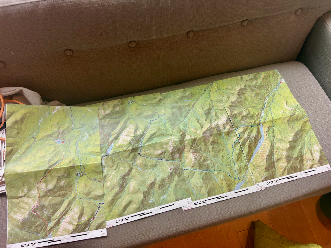
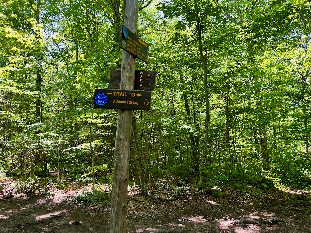
He also prepared the CalTopo map which, following Skurka best-practices, I had custom-printed on 11” x 17” sheets at 1:24,000 scale (as well as downloading all routes to Gaia GPS to consult on my phone). Toby (and Ceci) however preferred to use the excellent Adirondack Mountain Club “High Peaks Adirondack Trail Map”, which is detailed (and waterproof), but only 1:64,000 scale. Yet both kids know this wilderness so well after all their years at camp that they rarely needed GPS.
Day 0 – Friday
Getting out of the city on a Friday afternoon simply sucks! We stopped in Saratoga Springs for dinner, and arrived in Keene, NY, at about 10pm, where we had rented an AirBnB, a cabin at the Bark Eater Inn.
Day 1 – Saturday
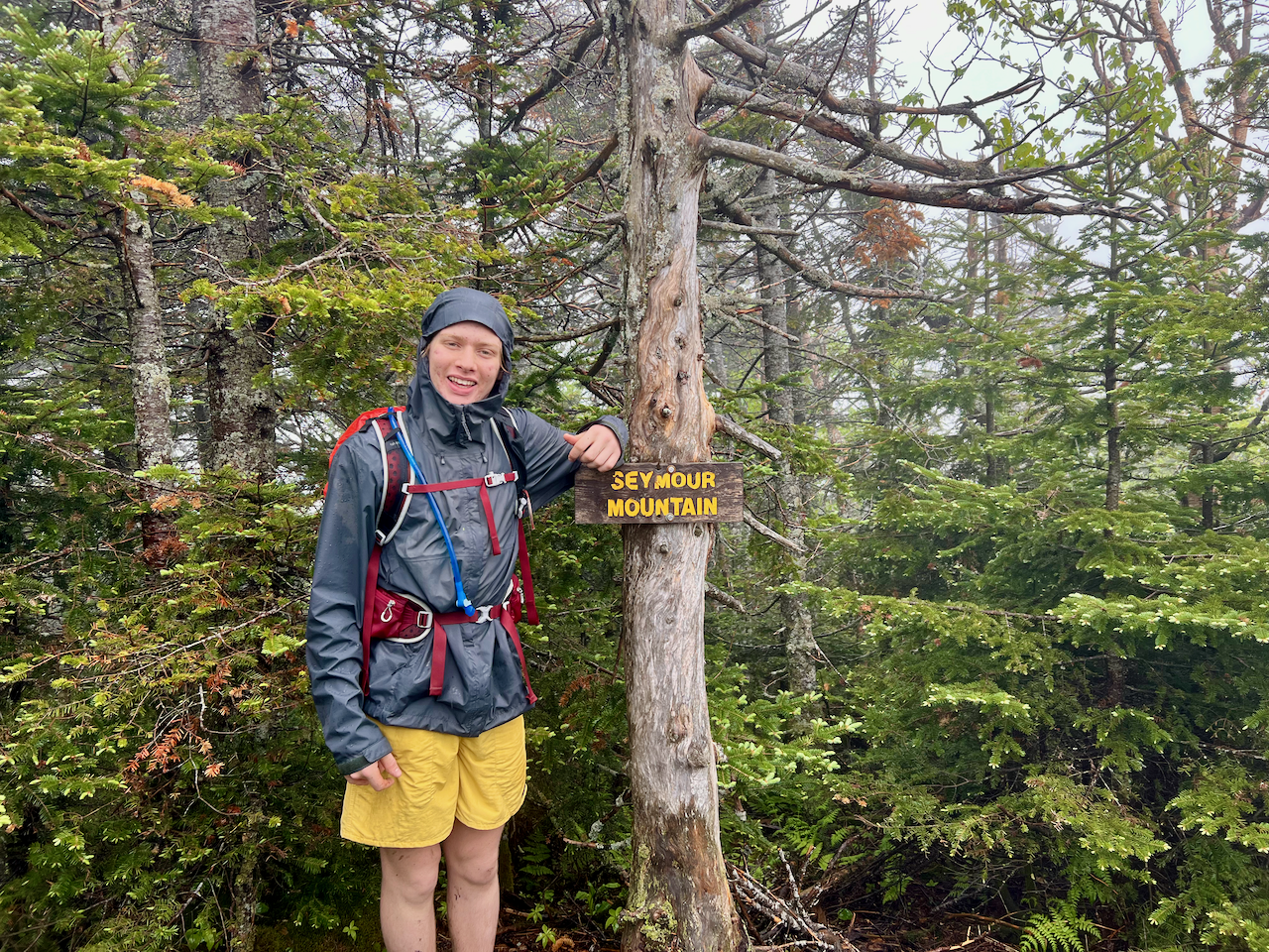
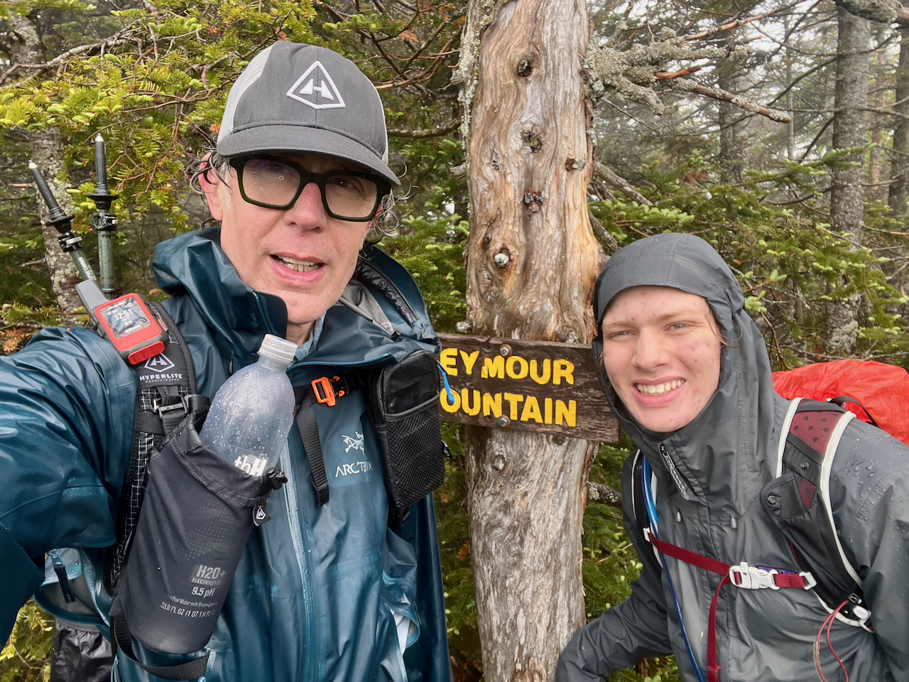
Day hike to Seymour. Ceci, having hiked this mountain, stayed in Keene and Lake Placid, shuttling us to and from the trailhead. Seymour is in the Seward range, in the northwest part of the Adirondack Park, and it was about an hour drive from where we were staying in Keene, so we couldn’t include this peak in our multi-day backpacking trip.
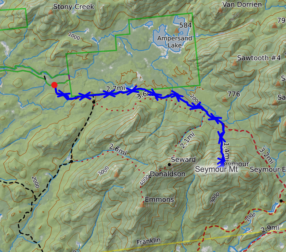
It was pouring rain, with little to no cessation (till much later in the day). The Sewards are known for being very wet anyway. The trailhead to the Seward chain is accessed from a remote road, but there were actually quite a few cars already parked, likely there the day before for overnights. Some hikers were sitting in their car as we arrived, and after we started gearing up and getting ready to go, they emerged from their car, exclaiming how stupid we all were trying to hike in the pouring rain. If this were not one of the only chances Toby had of completing Seymour, I surely would not have been there.
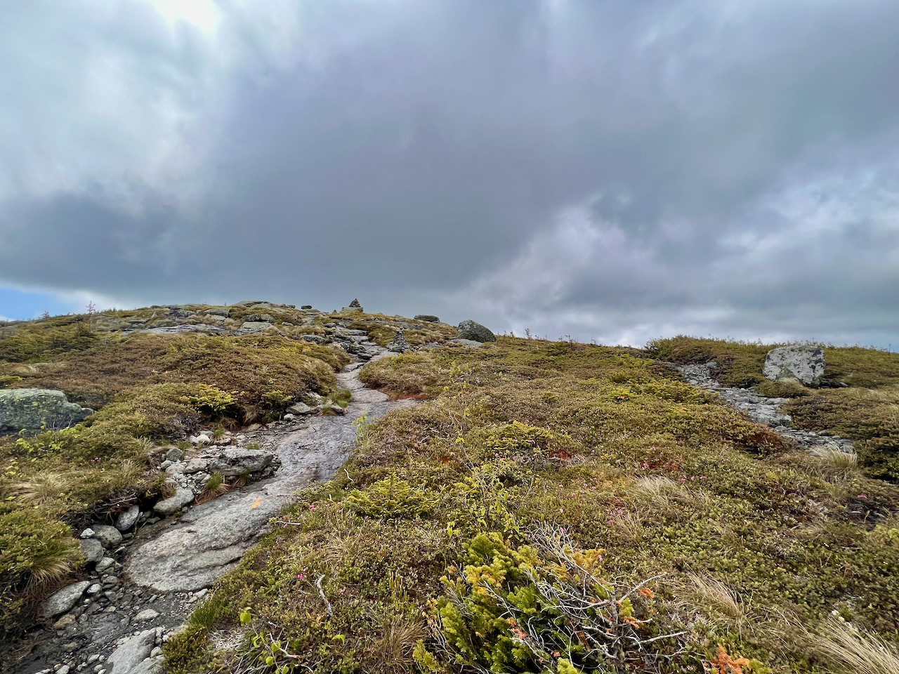
The trail starts very gently, rolling on through the woods for miles, passing a couple of lean-tos, and the junction for Seward, Donaldson, and Emmons.
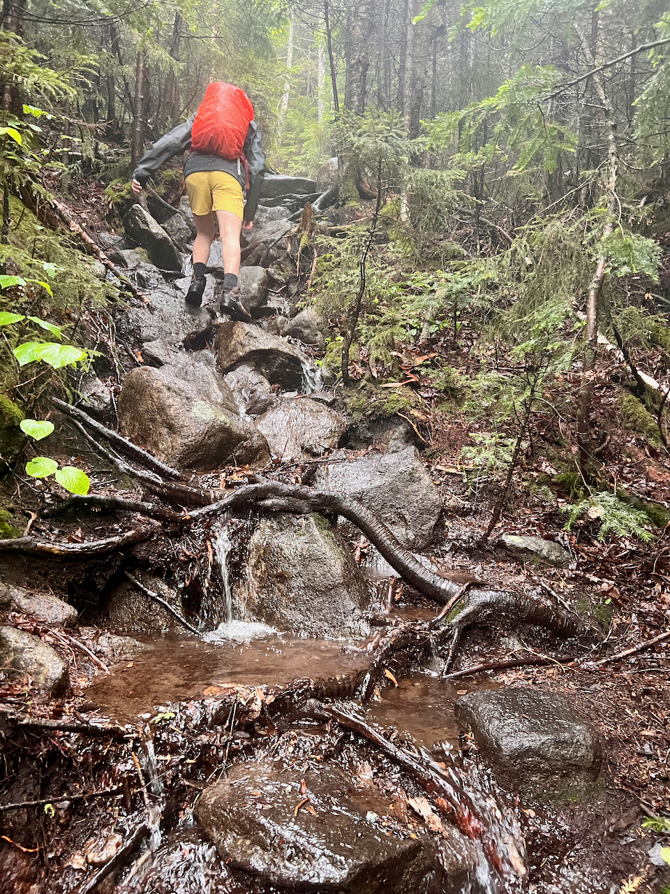
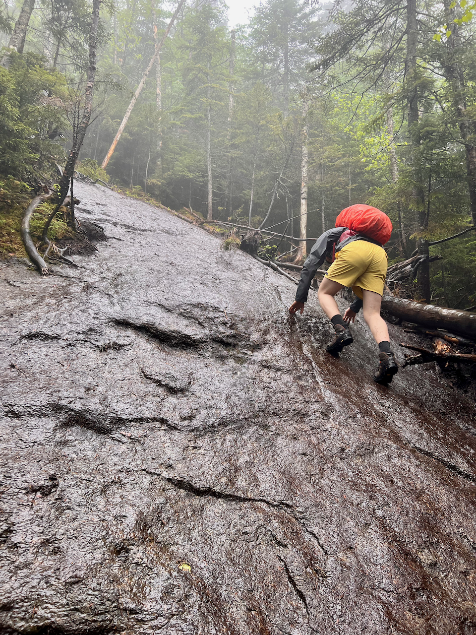
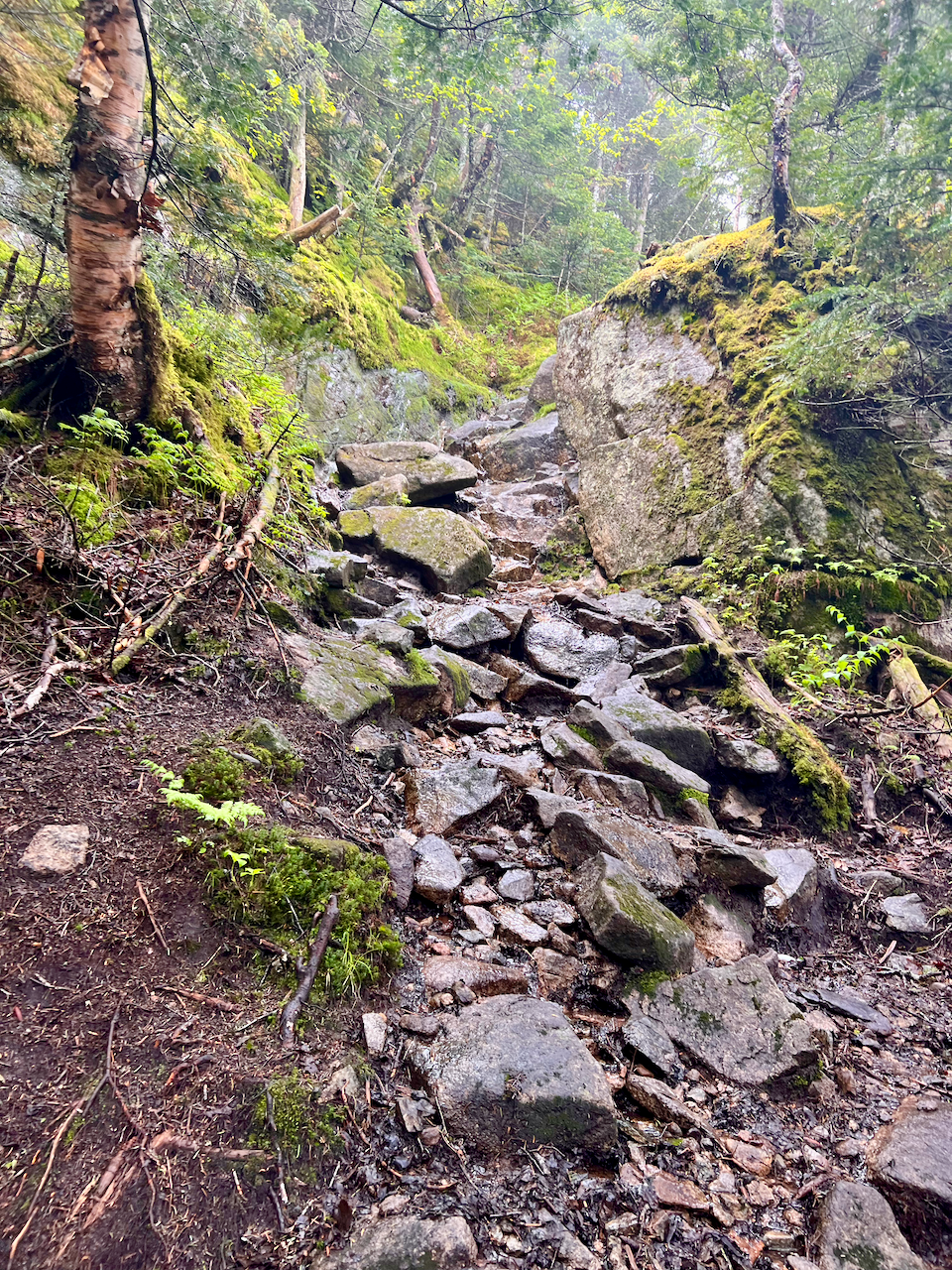
We carried on toward Seymour and the trail eventually transitioned to classic steep Adirondack hiking, ascending 2,500-2,600 feet in roughly two miles. I had only hiked Porter and Esther before this trip, and found this much more challenging. Of course the rain didn’t help, making the climbing over rocks and roots very tough going. There was some sustained scrambling – felt like 1/2 a mile, but likely less: just miserable in the rain.
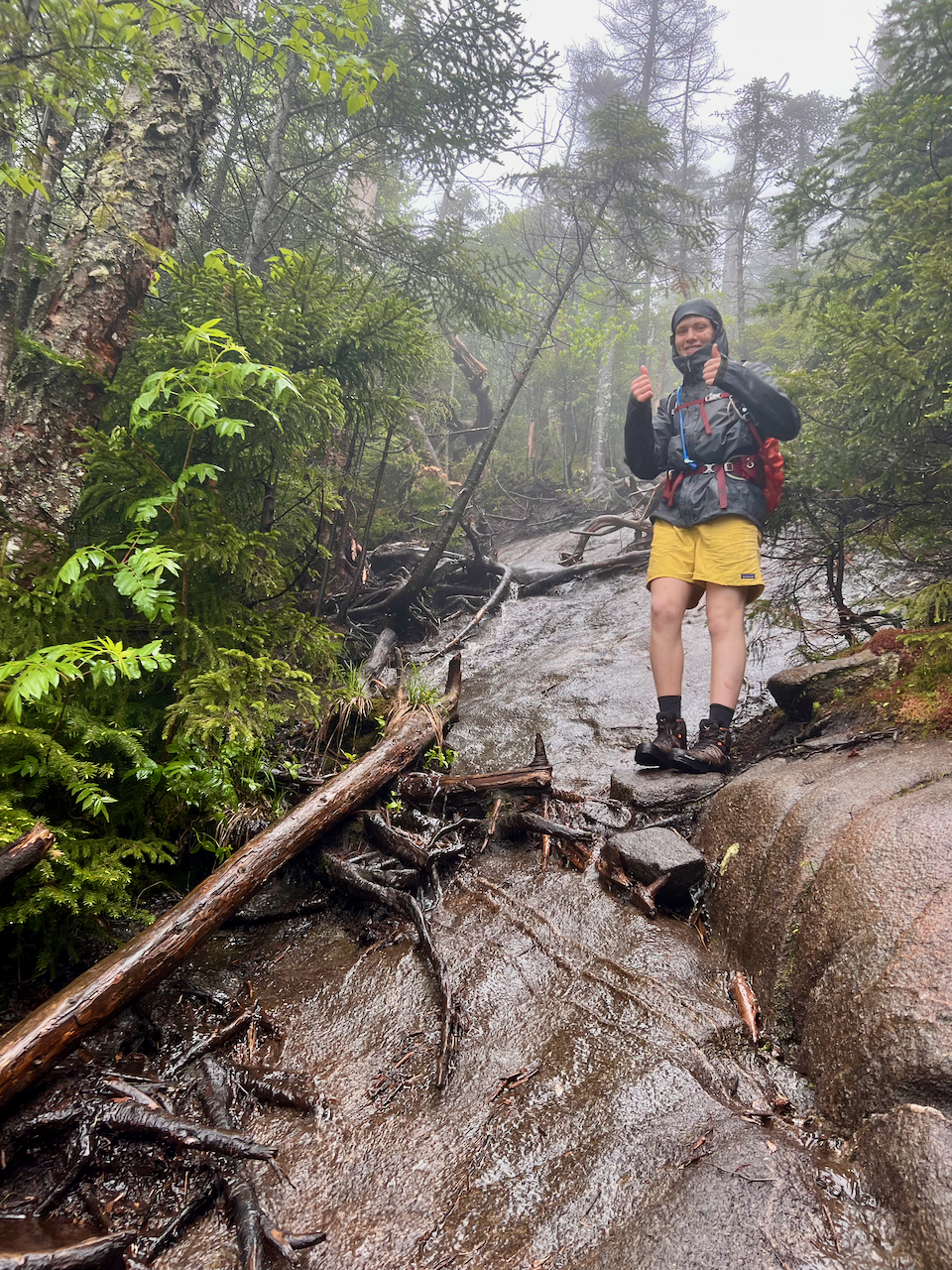
We skipped lunch at the top, wanting to get back down ASAP, but then found ourselves very cold and hungry on the descent, which made for some occasionally treacherous going, with our enervated focus. Tough day, but we had a good meal that night at the Forty Six restaurant in Keene.

Day 2 – Sunday
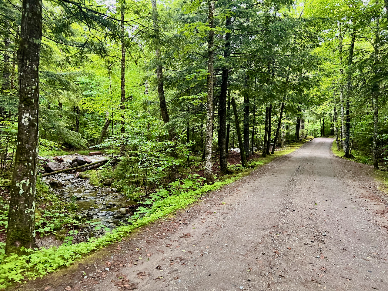
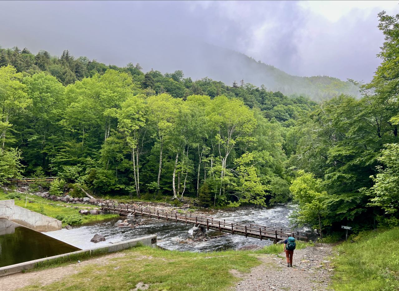
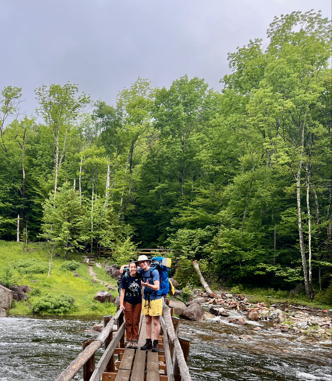
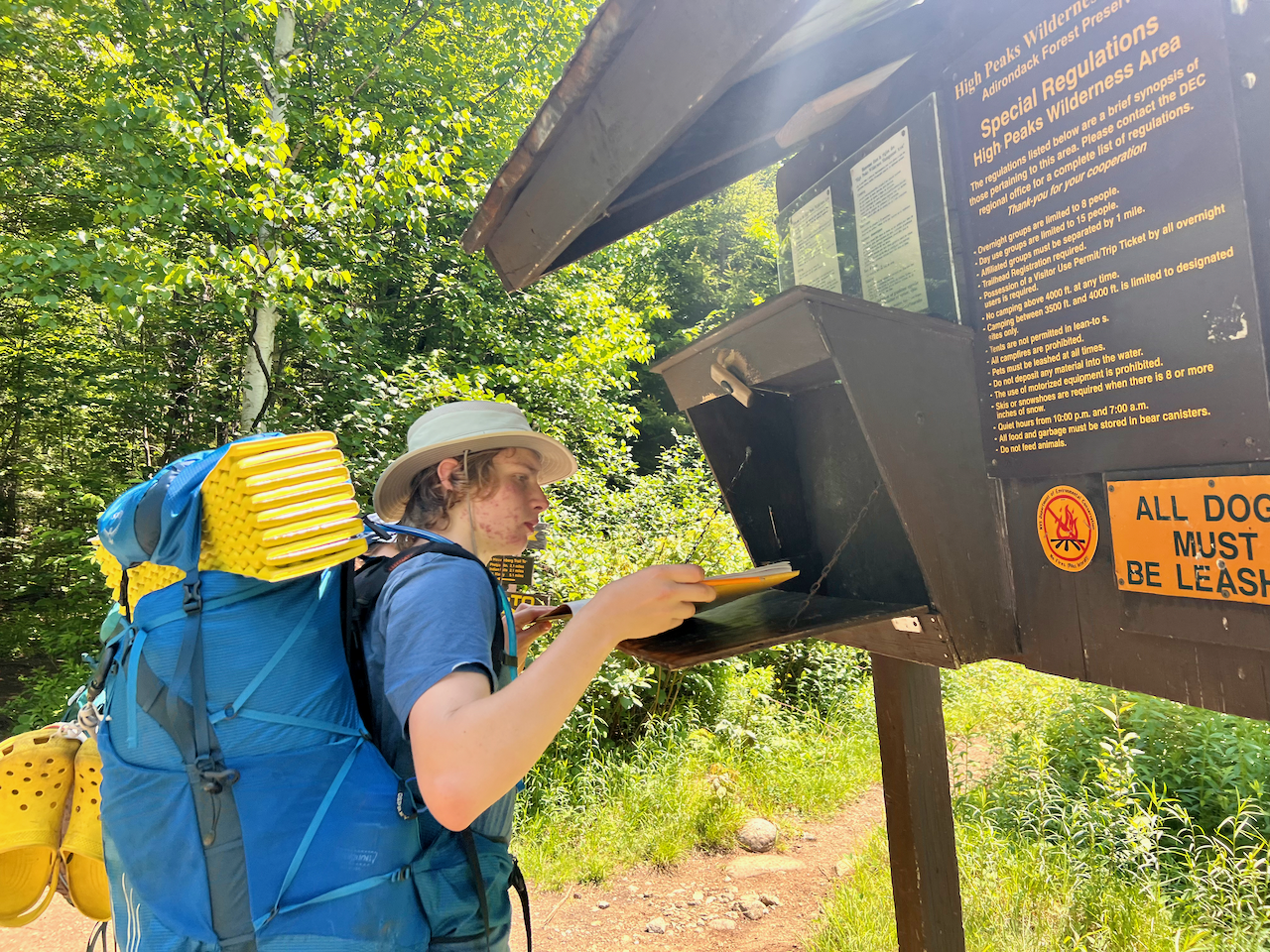
Very early start so we could get to the Adirondack Loj in time to secure parking. Surprised to find the gate attended, where they ask your travel plans, whether you have bear cans, and warn you about stream/river crossings, given how high the water has been. There were also trail stewards and DEC rangers in the parking lot, checking in with hikers. At 6:40am, however, there was ample parking (despite what I had heard to the contrary). Mark from The Mountaineer was there shortly after 7am and, after we exchanged greetings, collected our gear, and loaded it into Mark’s car, we set off, driving back down Route 73, past Keene, then Keene Valley, and into St. Hubert’s to the AMR/Ausable Club, where we had a reservation (required). Since we were not parking, the gate attendant allowed Mark to drive us closer to the entrance; we checked in again at the trailhead, and then started our hike. The first 3 miles carried us over the gentle lake road in the Ausable Club (this diverges from my Caltopo map somewhat) and we were booking it, excited to start, and this was likely the last time we would hike anywhere near 3 MPH the entire trip.
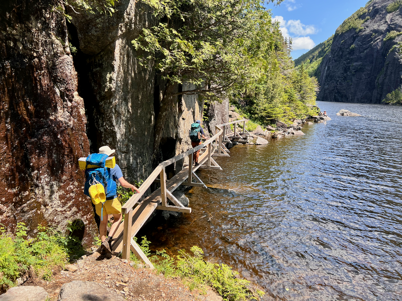
Crossing the big bridge over Lower Ausable Lake and the East Branch of the Ausable River (all still within the Ausable Club’s land) was a majestic way to begin our trip into the High Peaks.
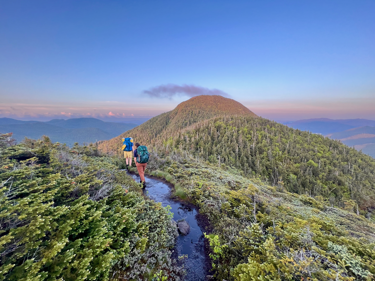
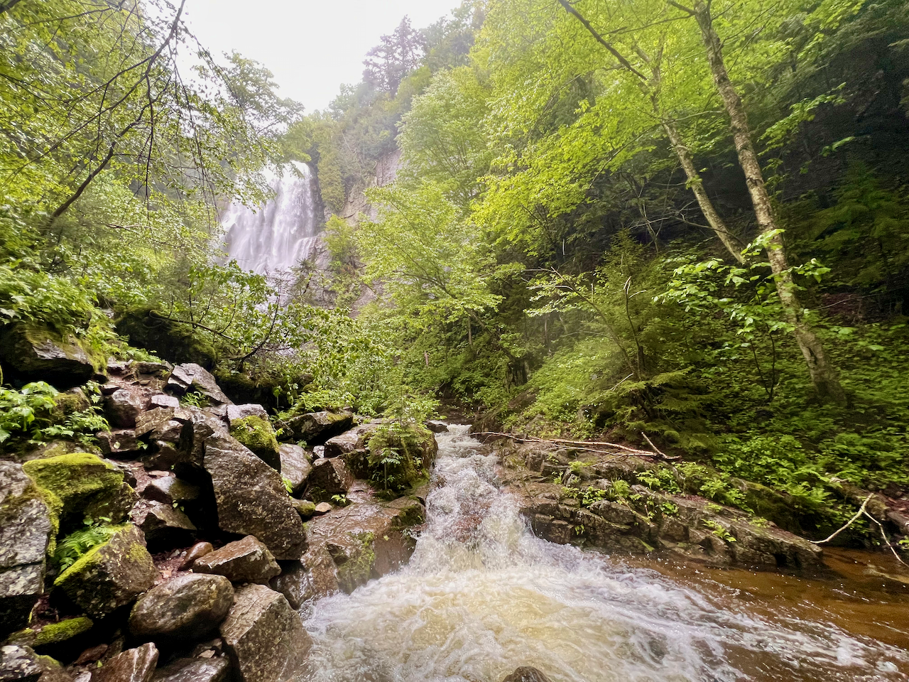
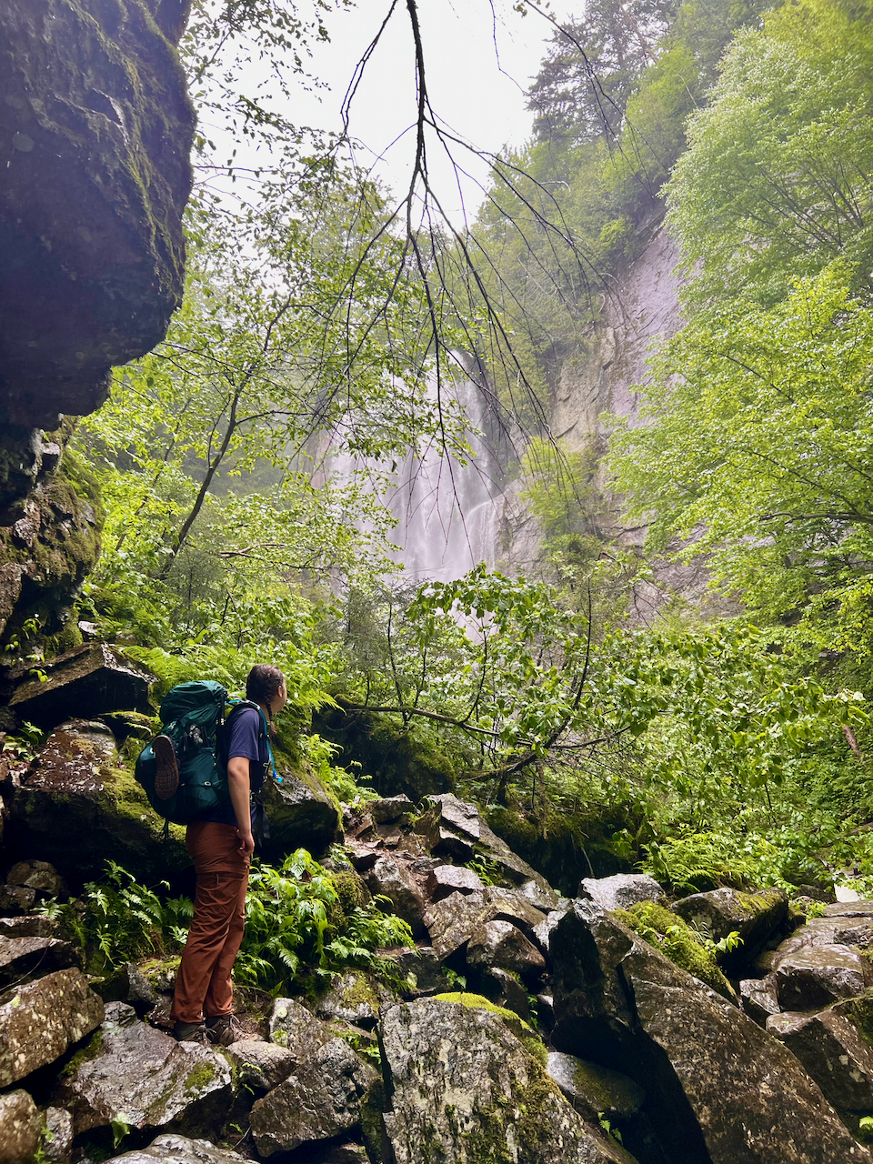
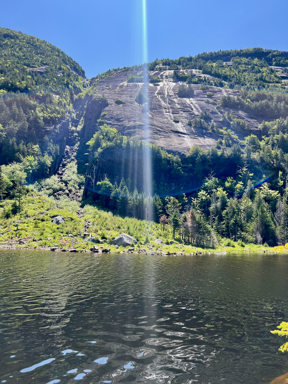
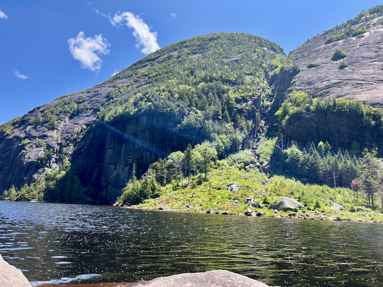
We began our climb to Sawteeth after a quick look at Rainbow Falls.
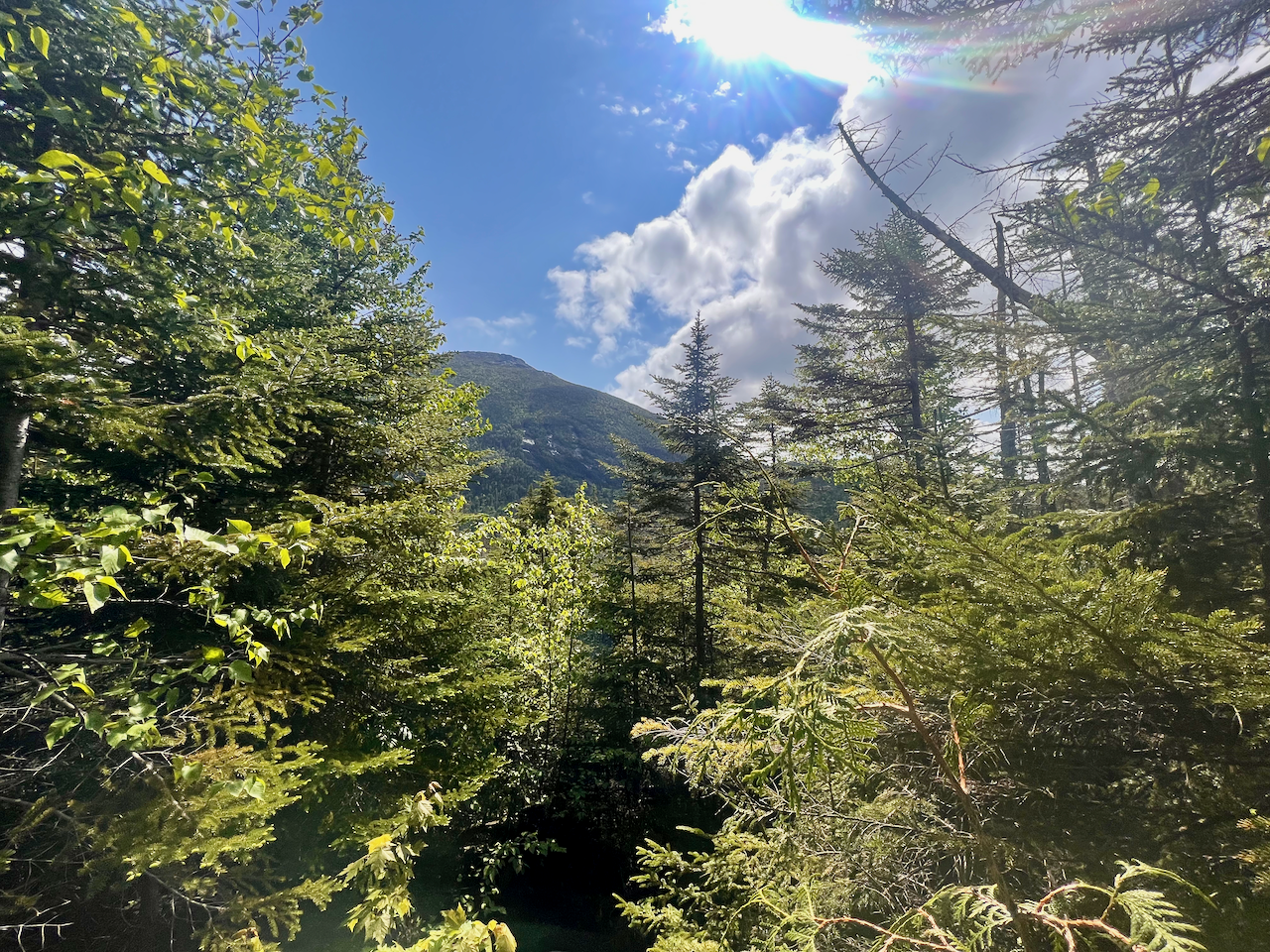
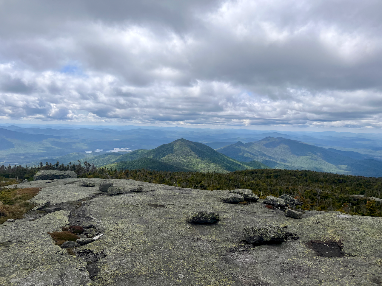
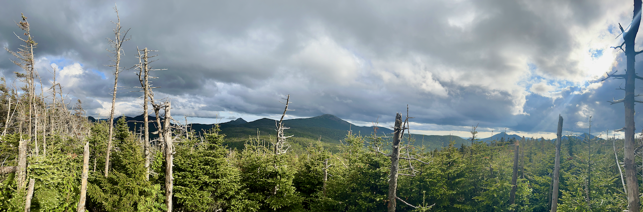
No rain this day, but overcast skies; the summit was socked in. We were sad not to have any real views, but excited that Toby had now tagged two of the four peaks he had left.
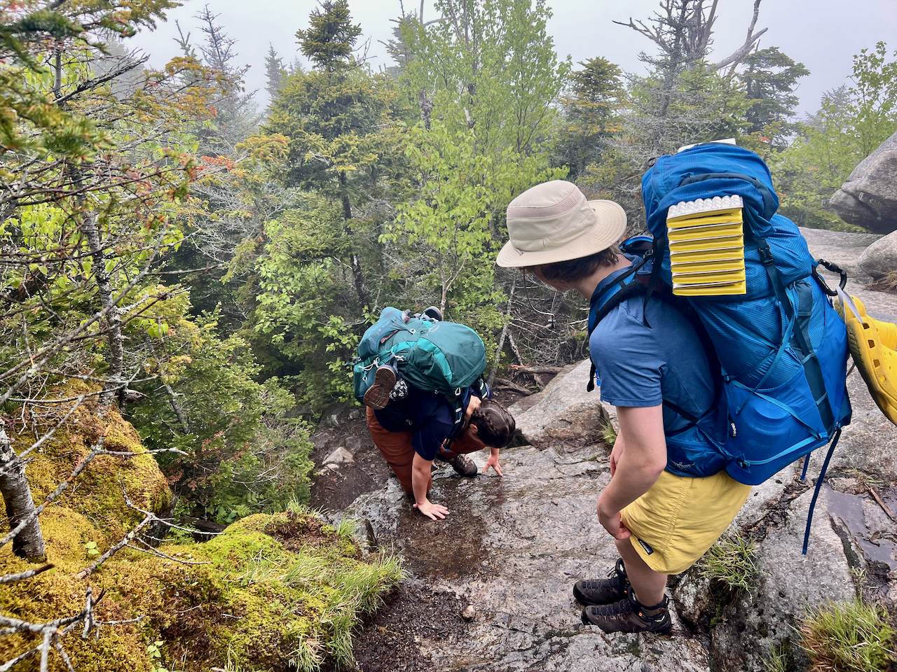
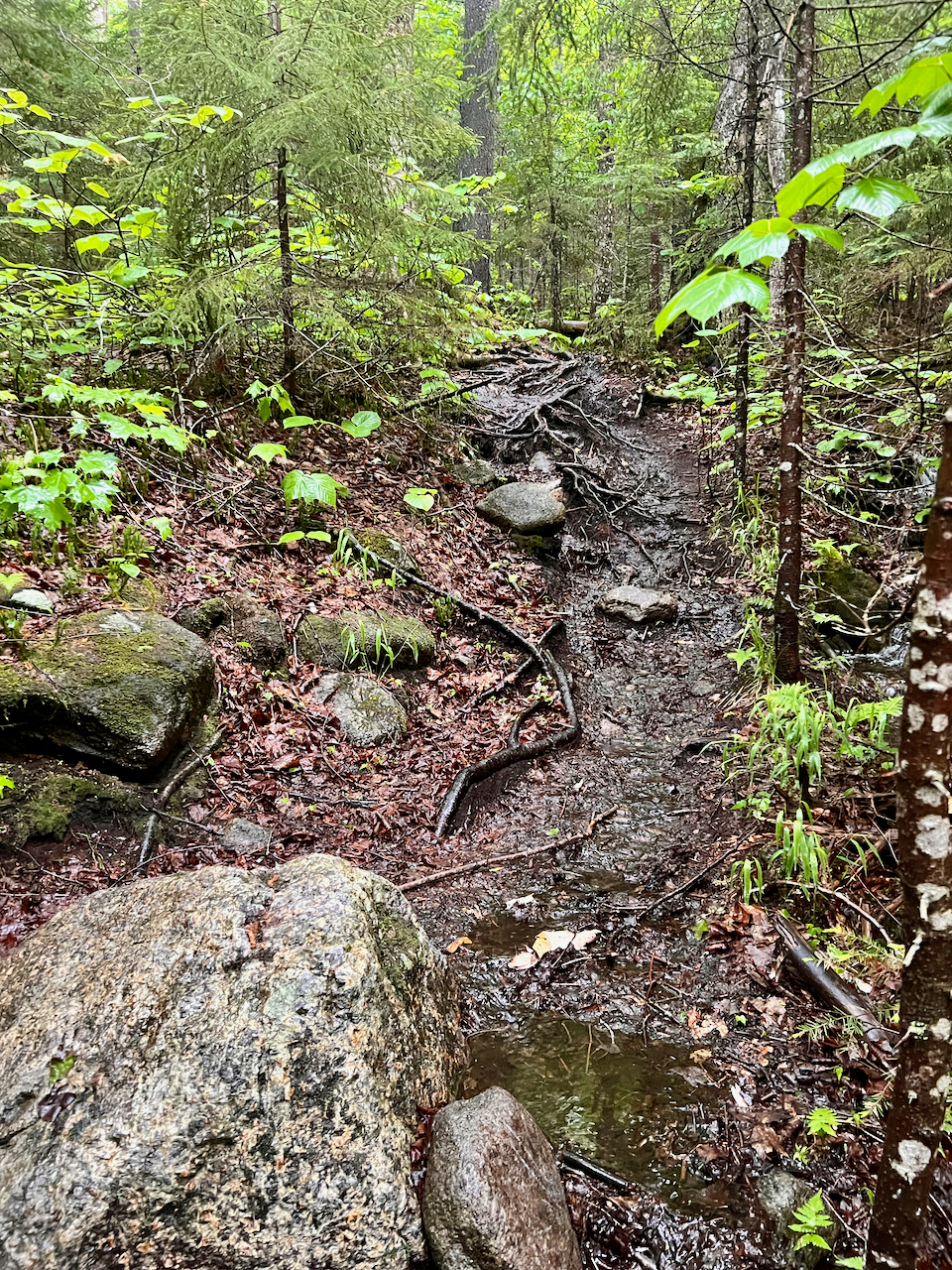
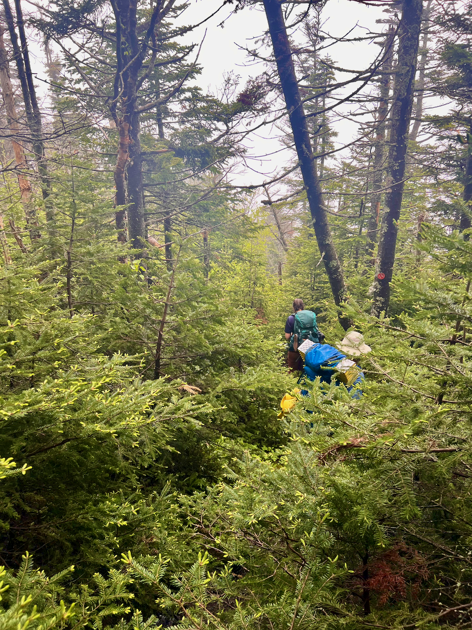
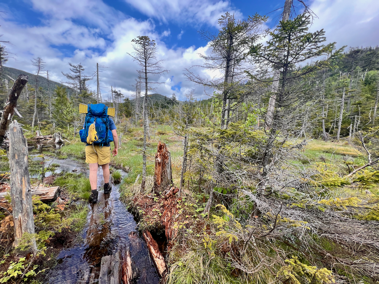
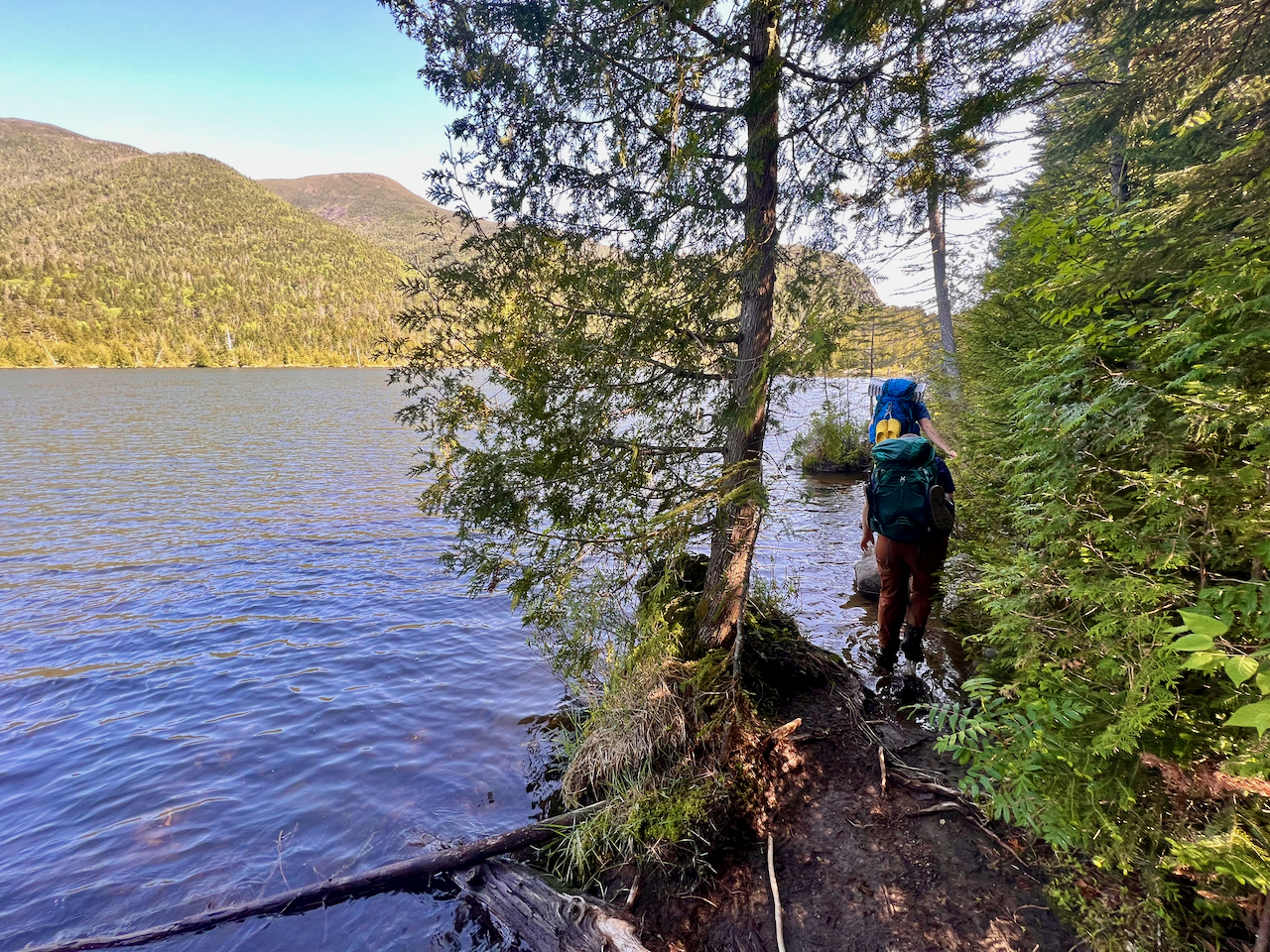
As you can see from the map, we came down off of Sawteeth on the south side, coming down towards Upper Ausable lake (and back onto Ausable Club land). But this trail felt like it was utterly unused, overgrown and thick with vegetation, almost feeling like a bushwack.
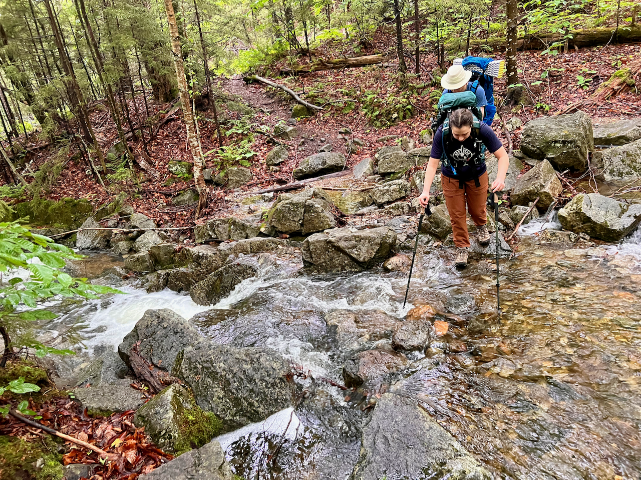
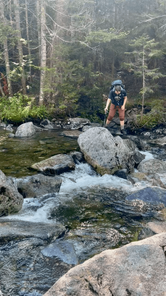
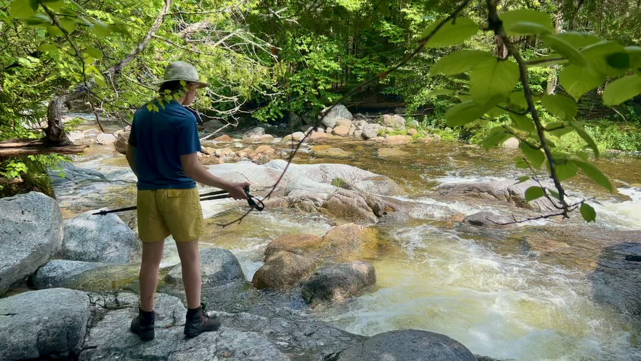
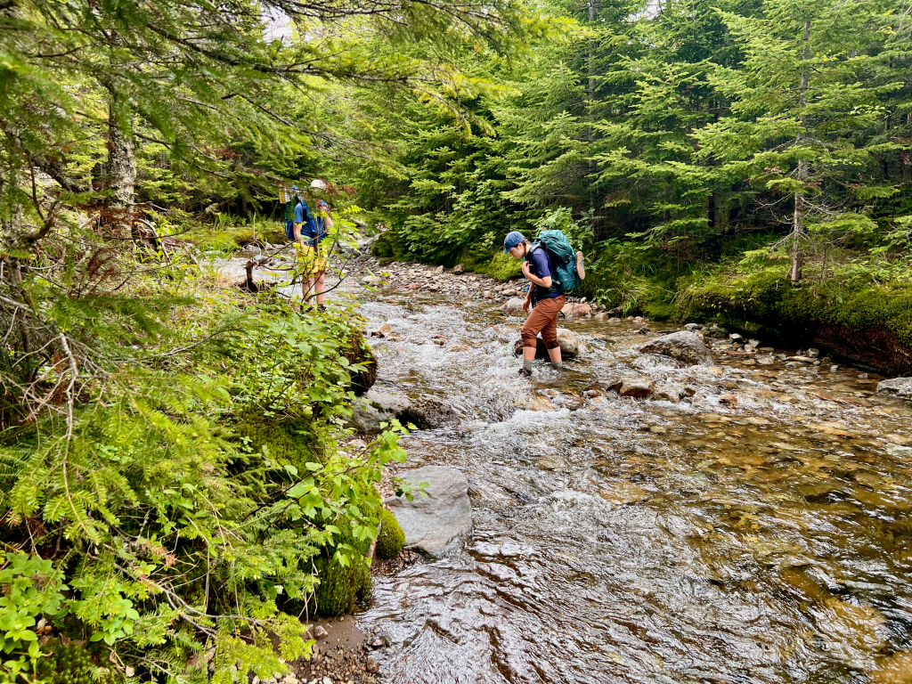
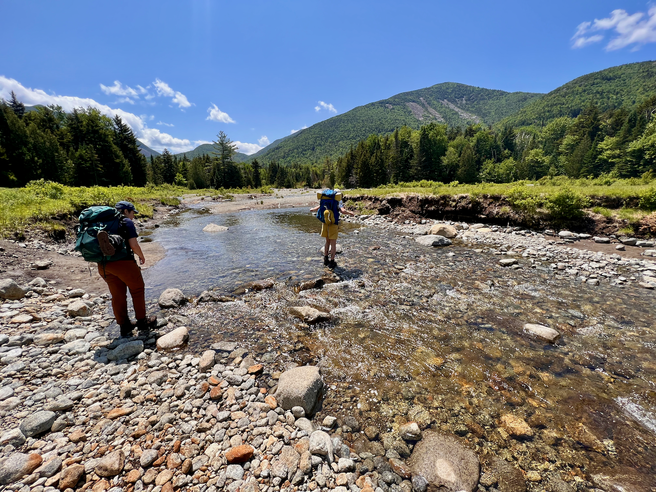
We also continued to need to make water crossings, and this time found that the crossing denoted by the trail map was simply unsafe.
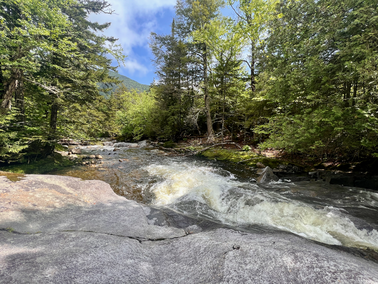
Toby scouted another crossing down stream via bushwhack and we eventually crossed.
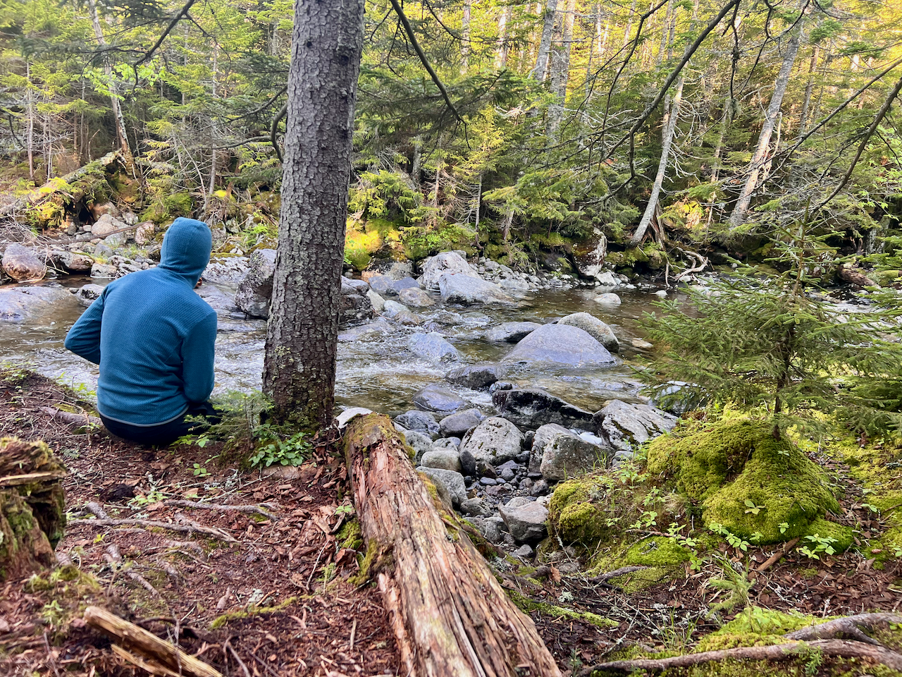
We climbed again, past Haystack on our right (north), and then hiked down into Panther Gorge, where we would spend the night. There was a lean-to that we had to ourselves next to Marcy Brook. We were all colder than we expected when we awoke early the next morning.
Day 3 – Monday
We had breakfast by Marcy Brook, broke camp, then proceeded to climb out of Panther Gorge, which is not a fun climb.
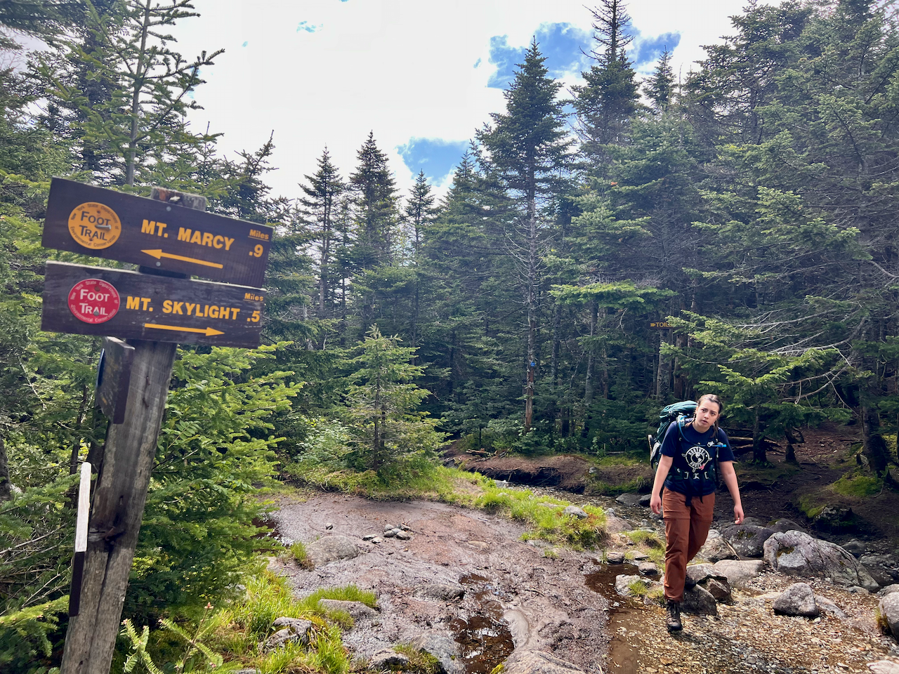
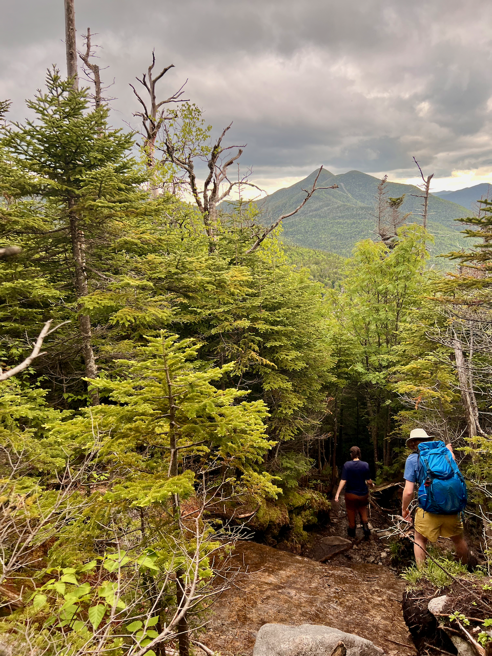
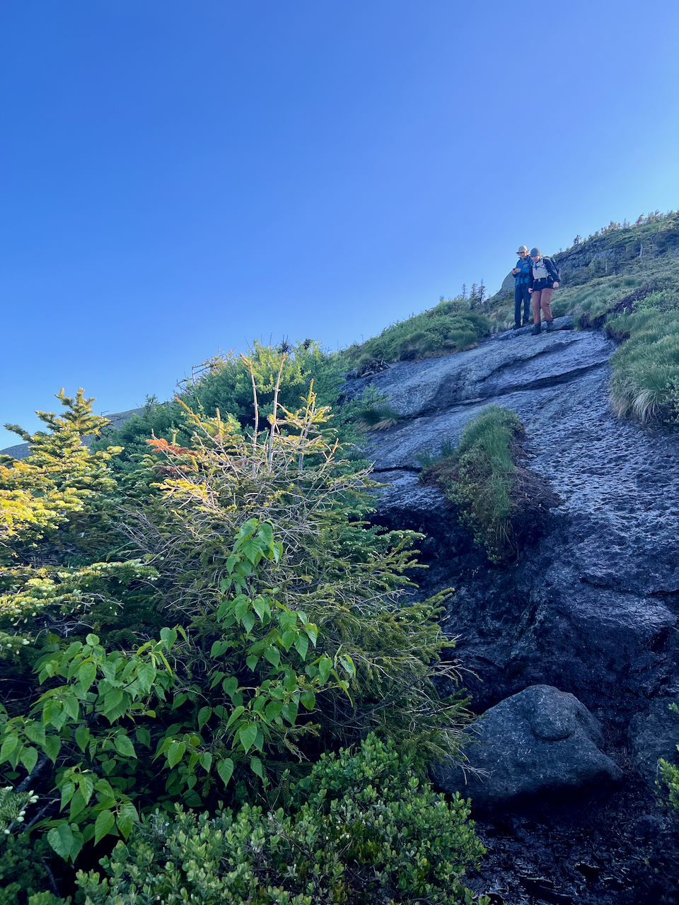
But we could start seeing Mount Marcy on our right, and at the “Four Corners” junction we dropped packs (save for one pack with essentials) and began the ascent to Skylight (which Toby had already summited, but we all wanted to do it).

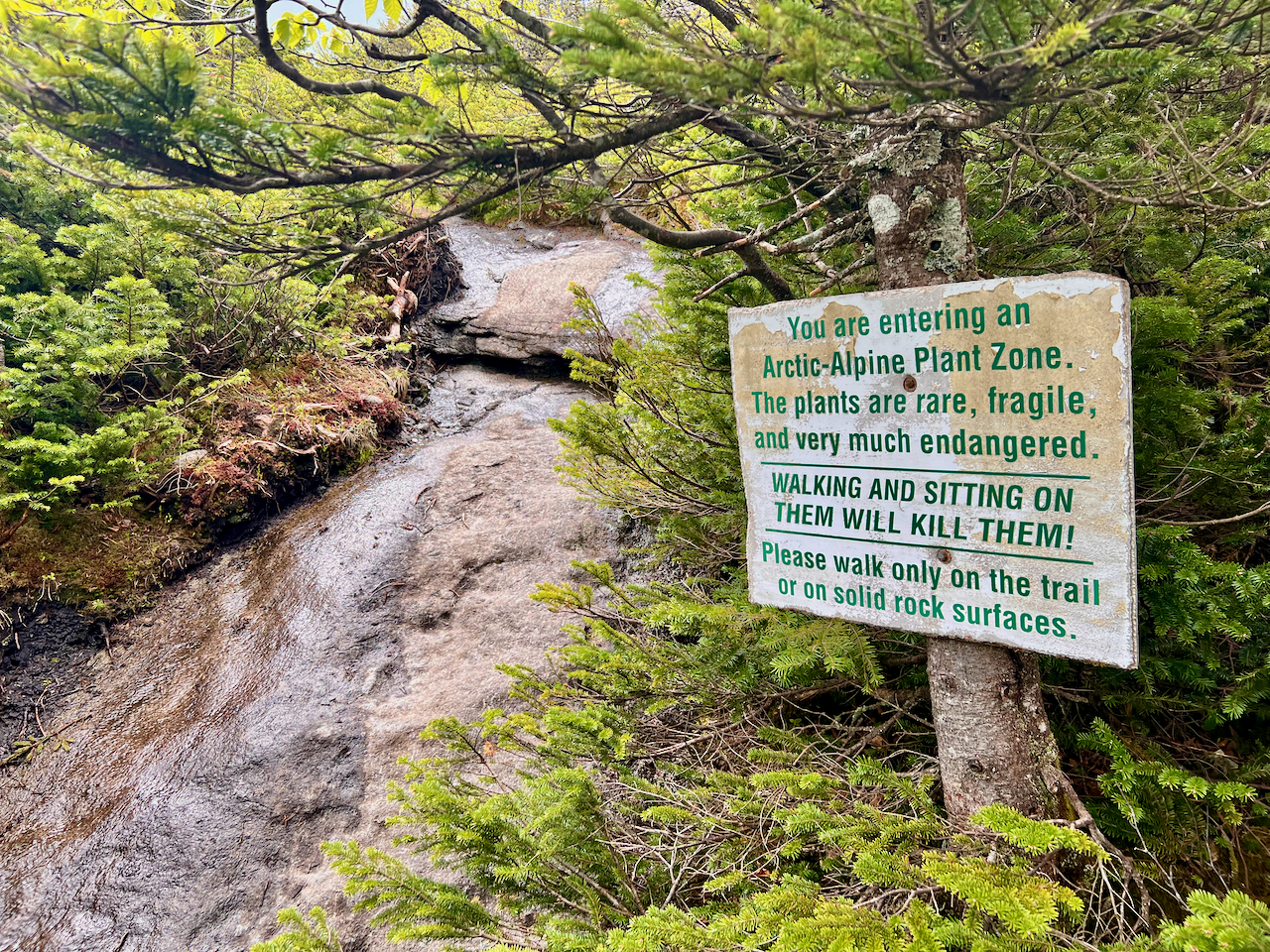
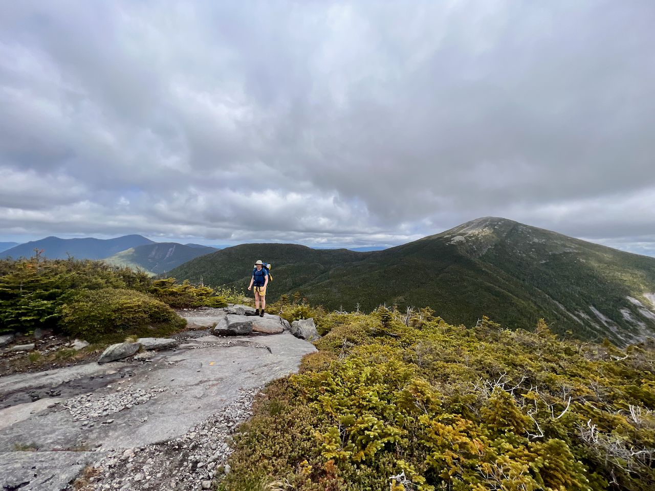
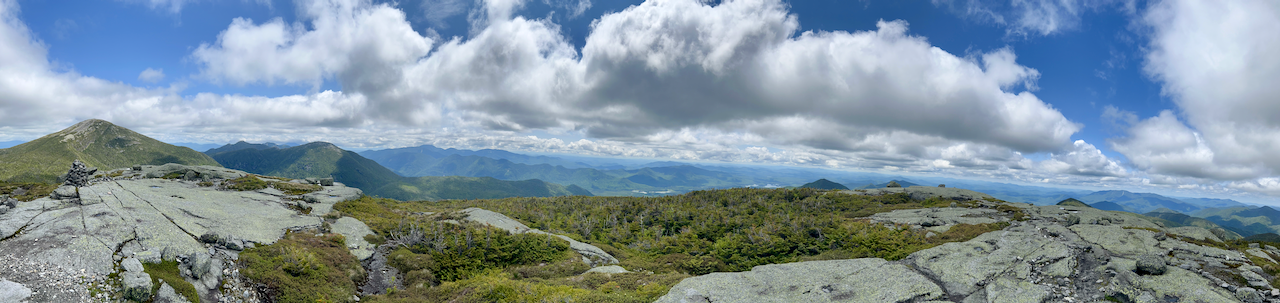
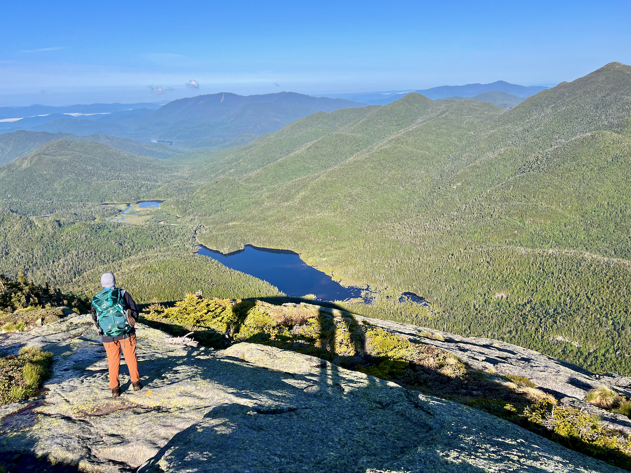
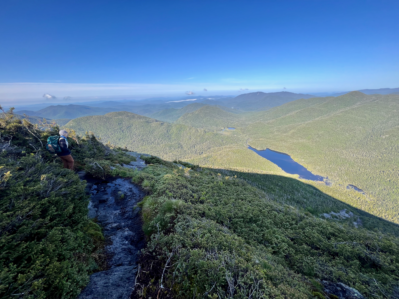
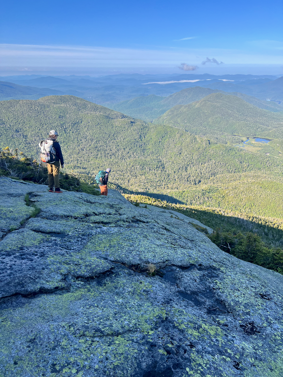
I felt Skylight wasn’t any harder than Sawteeth – and indeed both felt much easier than Seymour! – but of course there is still sustained climbing, and a long, broad approach to the actual summit. But the views from there are amazing! Great views of Marcy and Haystack, and numerous other peaks in a 360 degree panoramic view.
Coming down off of Skylight you return to the “Four Corners” junction, where we continued west on the Mt. Marcy trail, passing Lake Tear of the Clouds.
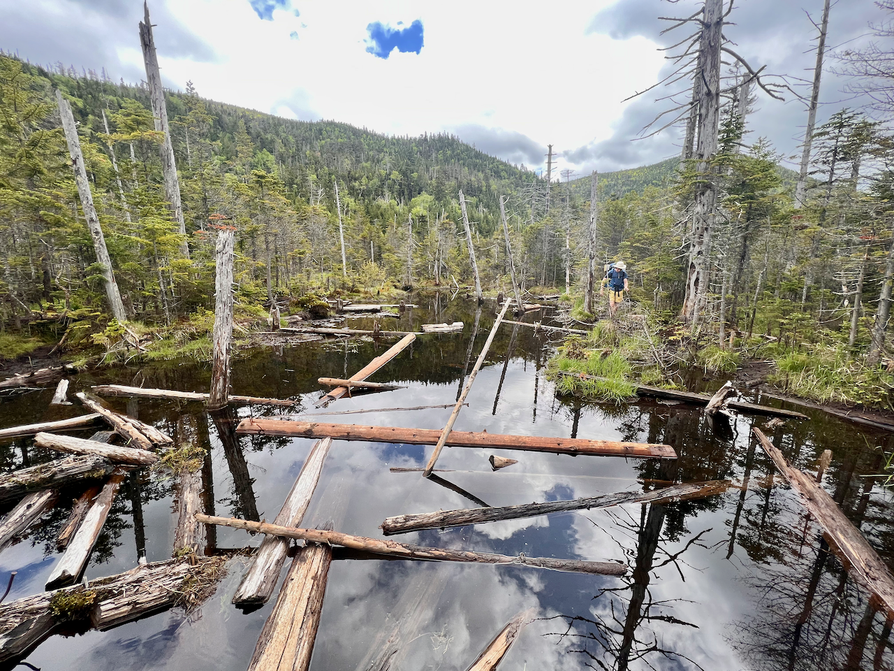
Then downhill to the Feldspar lean-to and then cutting north on the Lake Arnold trail along the Opalescent River.
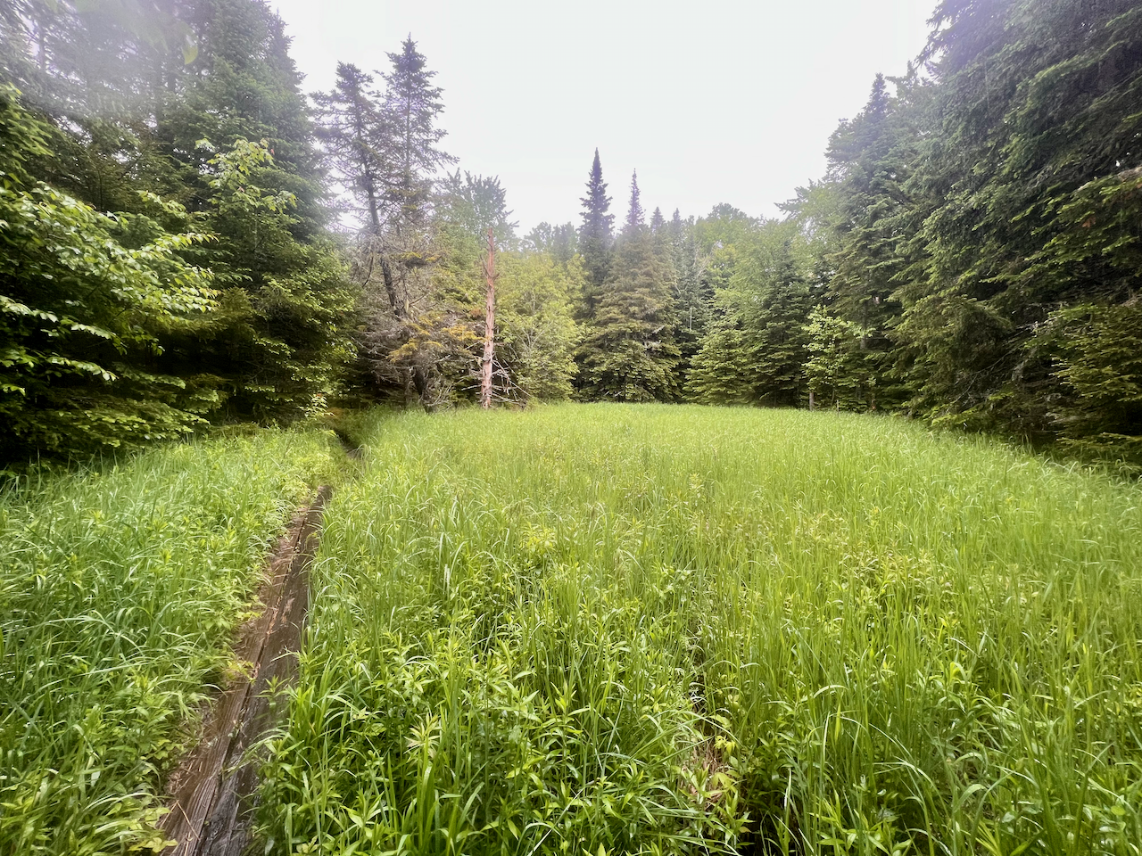
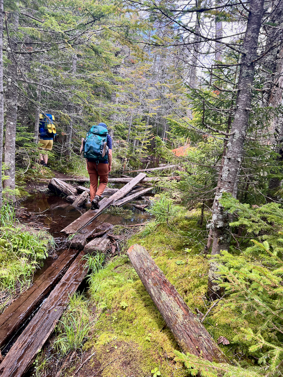
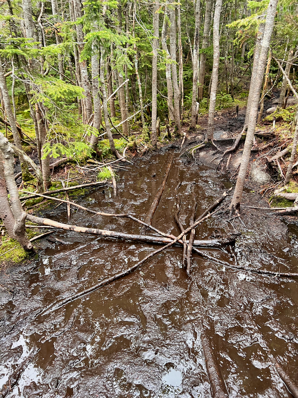
It’s here where the trail is a complete swampy mess with floating logs.
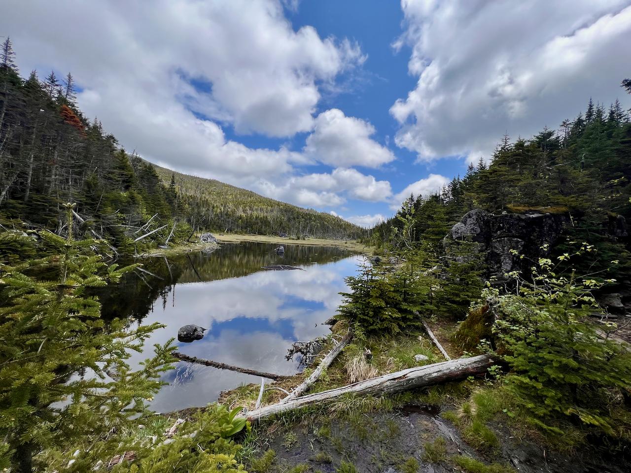
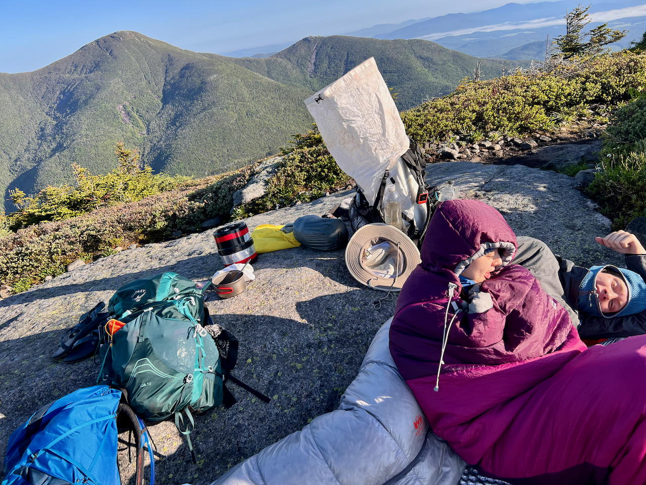
Lake Arnold is small and a bit swampy/muddy around the edges. The campsite nearby is not pleasant at all, alas. We pitched our two tents, but as noted, the large footprint made for a challenging pitch, and my tent’s pitch was particularly poor.

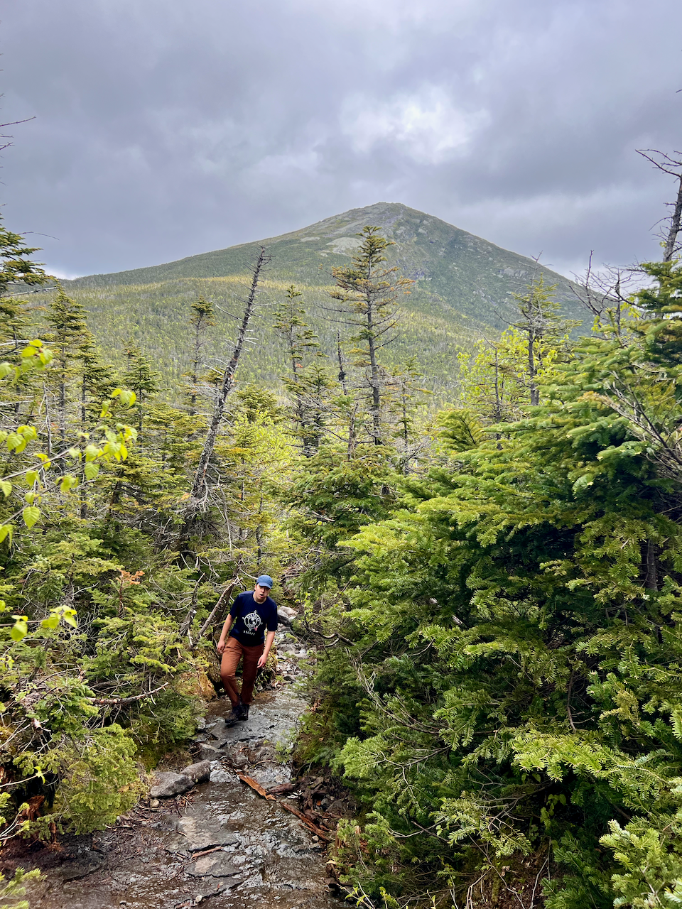
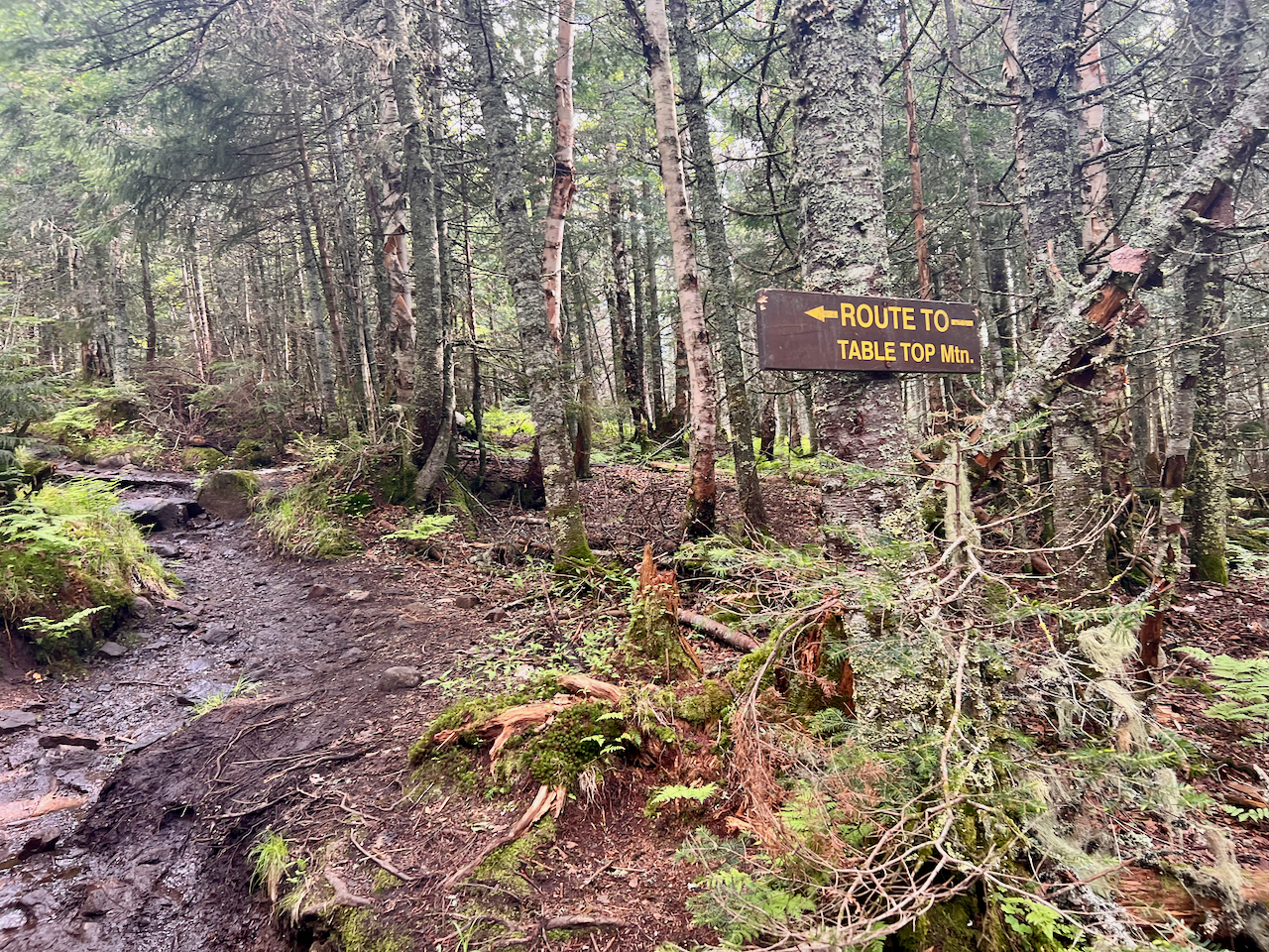
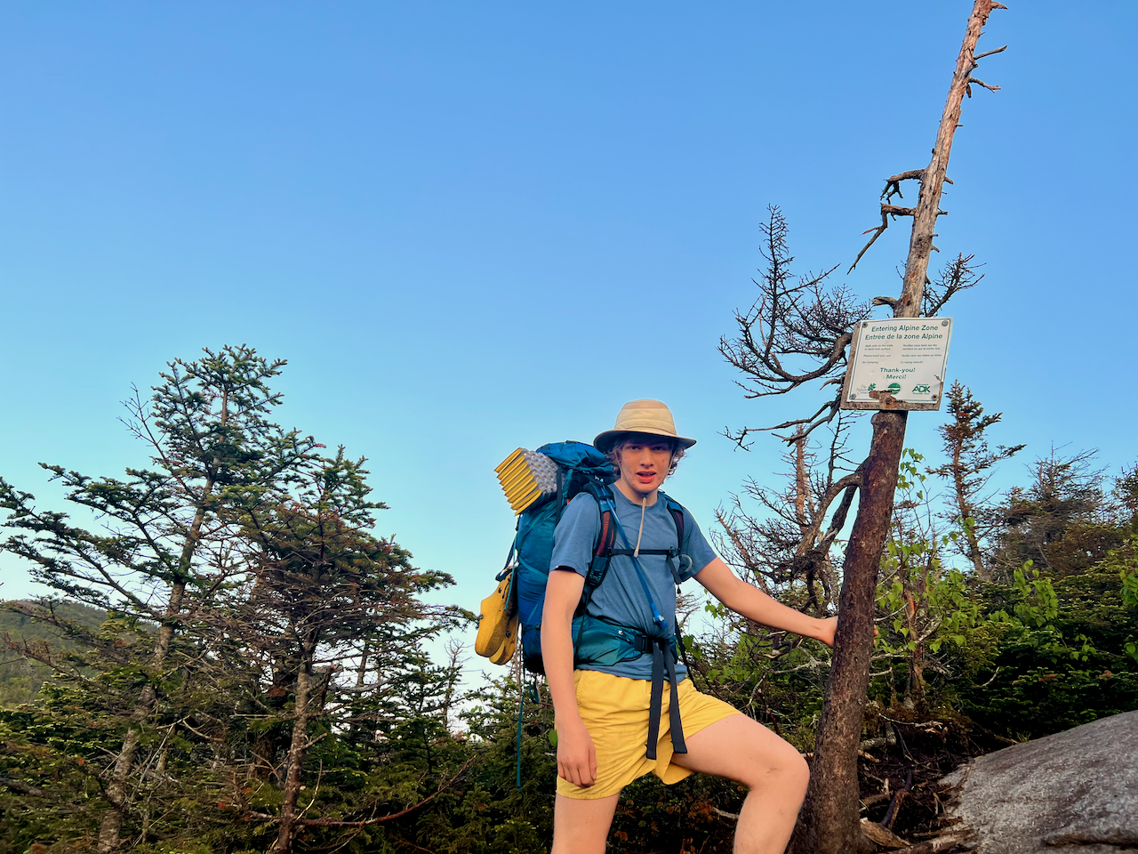
We dropped packs again (save for a summit pack with essentials) and proceeded to hike up to Table Top, Toby’s penultimate 46. It was much later in the day than we had hoped/planned, but so close to the Solstice we had abundant daylight.
Day 4 – Tuesday
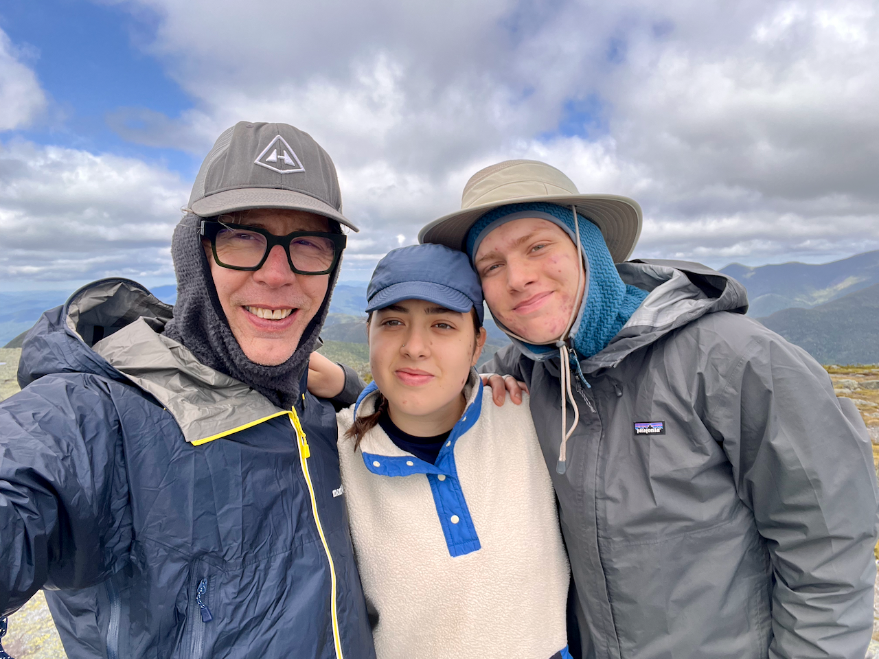
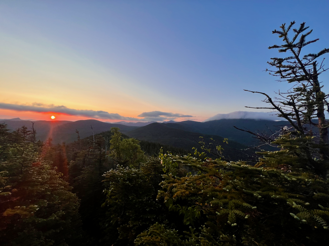
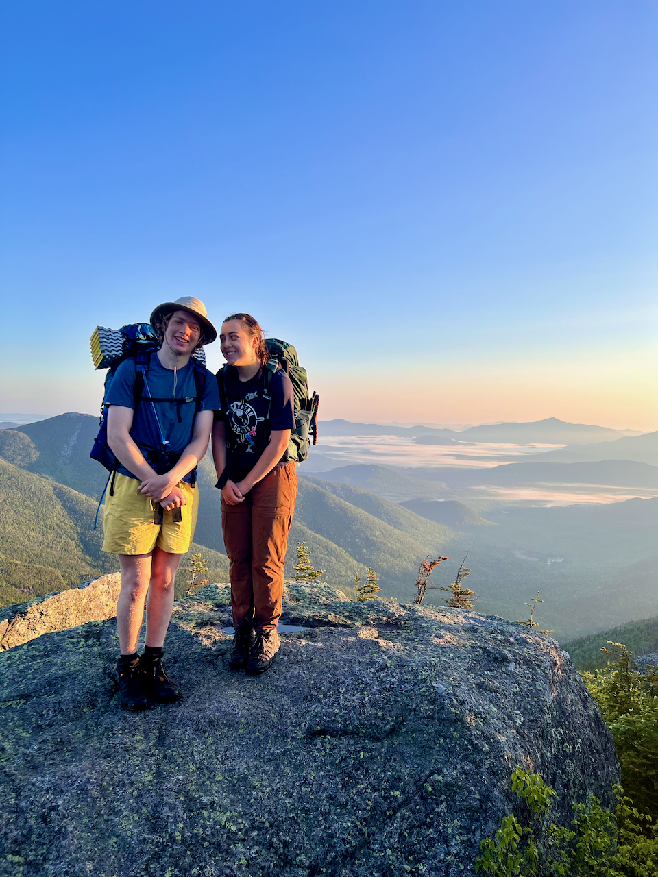
I slept poorly in a poorly pitched/sited tent, but it likely didn’t matter, as we arose at 3:30am in order to break camp and try to get up to Colden in time for sunrise. Absolutely beautiful hike up in darkness and early morning light as the sun just began to emerge over the eastern peaks.
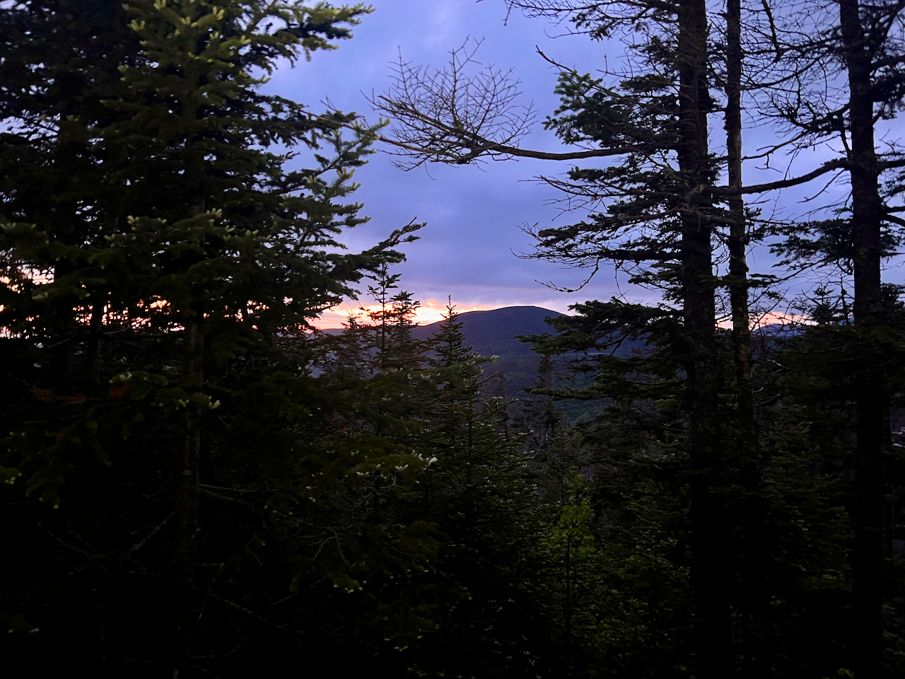
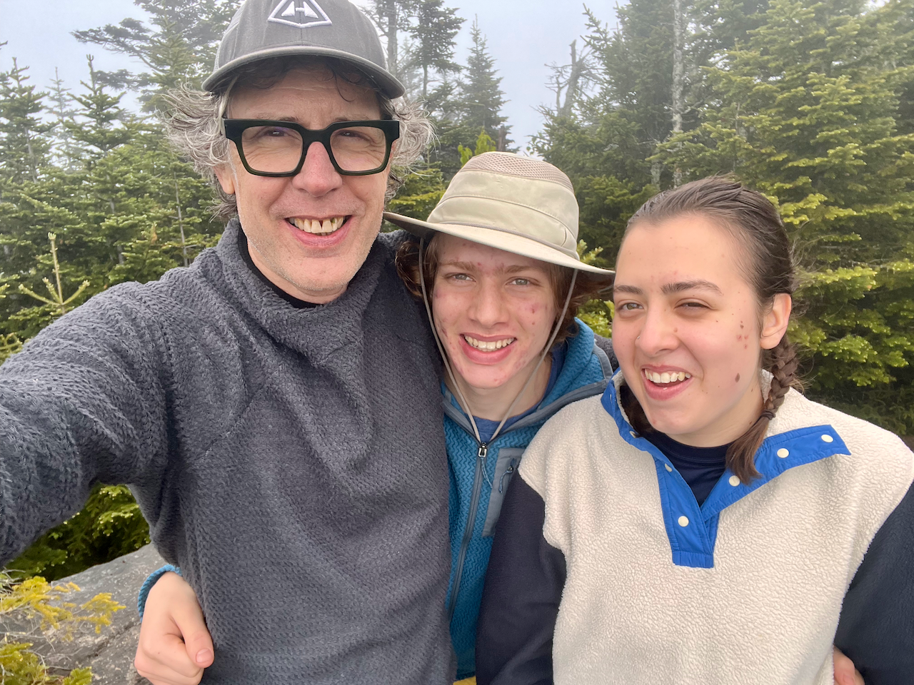
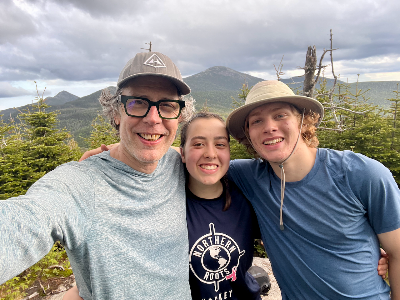
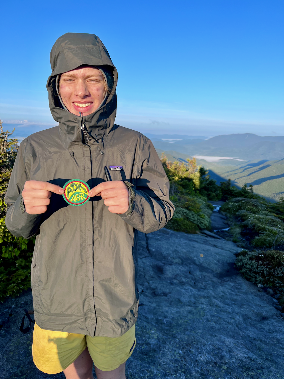
Birdsong was abundant and it was kind of amazing to listen to in its incessant, rhythmic cadence. We summited Colden just a few minutes past sunrise and Ceci celebrated Toby’s achievement by presenting him with his 46-er patch. We then hung out on the rocks having our breakfast and taking in the views (and resting a bit before the steep descent).
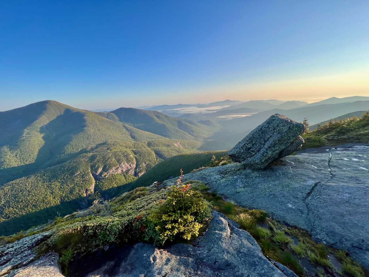
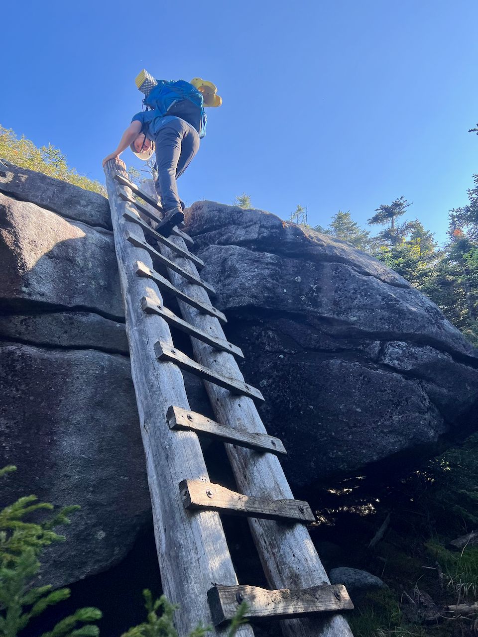
The descent on the western side of Colden is no joke, with lots of slick rocks, but also lots of steep ladders. It’s a beautiful descent, as you take in views of Lake Colden below. Once we reached the lake, we navigated north towards Avalanche Lake, and then on to Avalanche Pass. We took lunch by the lake, watching climbers attempting the infamous Trap Dike along the western side of Mt. Colden.


Continuing out on Avalanche Pass Trail towards Marcy Dam we ran into quite a few day hikers, and fewer backpackers (it was Tuesday). One last water crossing by Marcy Dam, and then we flew down the last couple of miles of trail towards the Loj to complete the trip.

Leave a reply to Mom/Grams Cancel reply