This is a trip report, with photos, of a short overnight backpacking trip I did in the Catskill Mountains last weekend (Saturday and Sunday, October 29th and 30th). I’m experimenting with this new format (WordPress), because – among other reasons – neither Apple nor Google photo sharing software offer the affordance of captioning photos (at least not in a way that doesn’t detract from the user experience).
Background
Most of my weekends are booked up with hockey, but late last week Toby’s Saturday game was cancelled, leaving me free this previous Saturday through Sunday until about 5pm, when he had another game. I debated doing a long day hike on Saturday back up in Harriman, but realized that since my wonderful Olympic trip I missed camping – and likely wouldn’t have another chance before winter set in. Toby had plans to see camp friends who were in town on Saturday; and he had a lot of school work: so he declined. So I was left debating whether I wanted to do a solo overnight camping trip. Remembering how well the Olympic trip went, as well as how successful the shakedown trip was that Toby and I did in the Catskills the week before my Olympic trip, I decided I was ready to do it: I was confident I could prepare well for the trip (even in a short period of time); and having done a lot of solo day hiking I knew I’d enjoy my own solitary company for two days.
Preparation
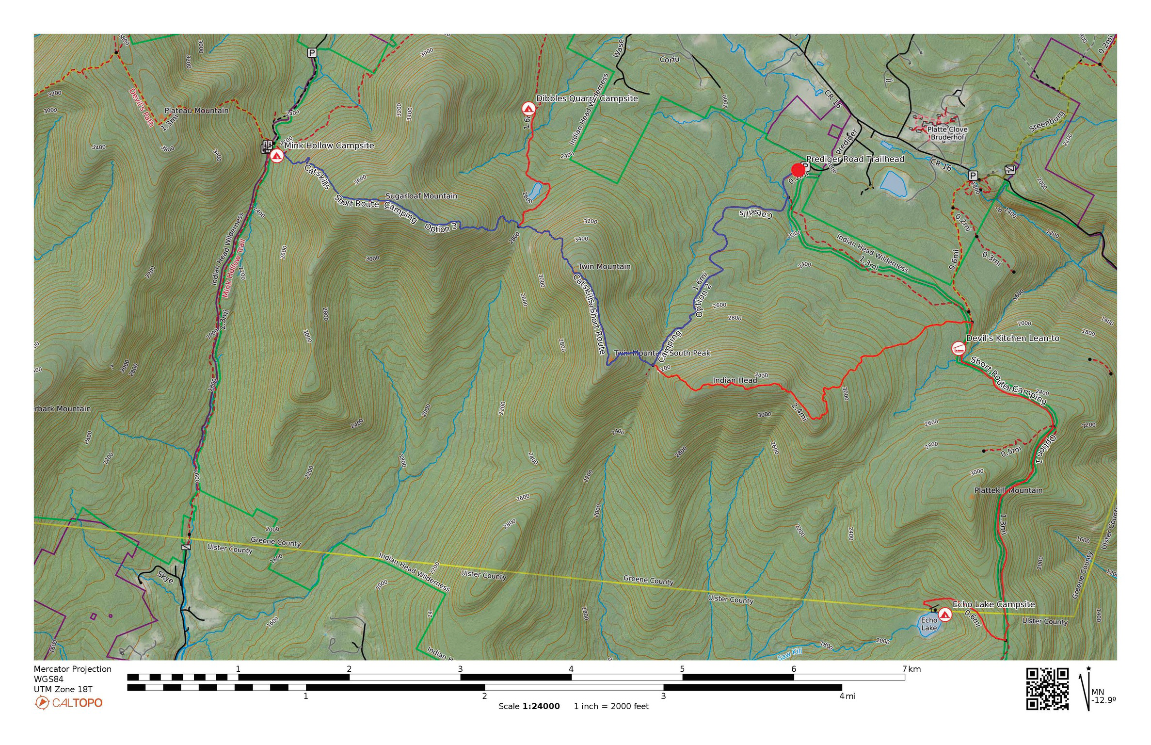
Thursday found me quickly researching trip options in CalTopo (taking my cue from Andrew Skurka’s methodology) eventually working up a map of three route and campsite options. The idea was to have an interesting, somewhat challenging hike, but limit the mileage so I could hike back out on Sunday and be back at the car by noon or so, leaving time for the drive back to NYC, and accounting for the possibility of traffic. I determined that the Prediger Road trailhead in Elka Park, in the Catskills (not far from Saugerties), afforded a few options, with access to some of the classic challenging Catskill mountains (Twin, Indian Head, Sugarloaf), with a number of options for campsites: I wanted some optionality in terms of where I hiked and camped once I arrived at the trailhead that day.
I gathered my gear together fairly quickly, using the detailed gear list spreadsheet I used for the Olympic trip (but with revisions/deletions). With nighttime temps in the 30s I knew I’d be warm enough with my 22F quilt. But unlike on the Olympic trip, I packed both my fleece and puffy. On Friday I picked up my 11×17 1:24,000 topo maps from the printers, downloaded my routes to GaiaGPS, shopped for some more food, printed out the gear spreadsheet, and began marking off items as I packed into Friday evening.
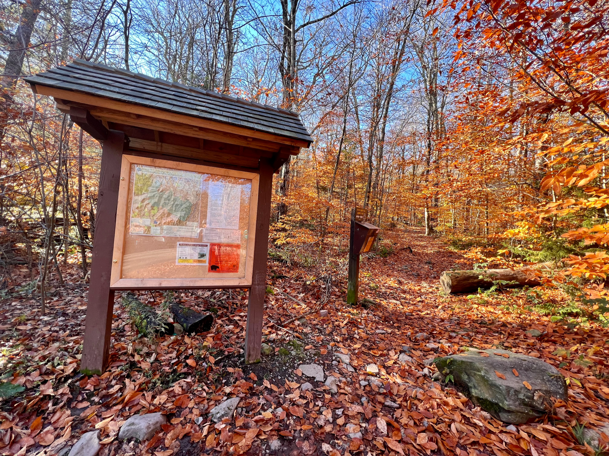
Trailhead
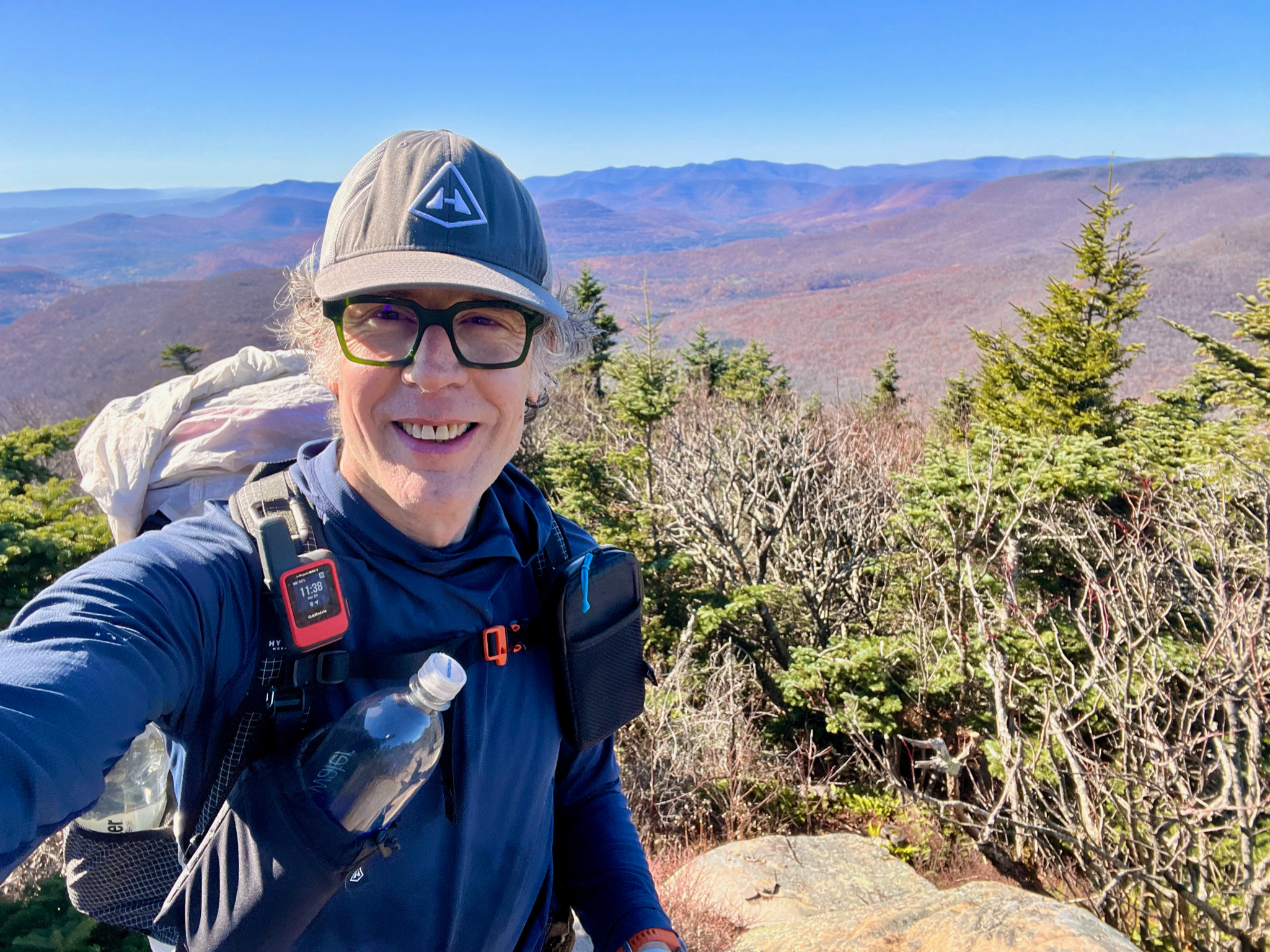
I was on the road at 7am on Saturday, arriving at the trailhead around 9:15am. Day hikers were already arriving, but few if any of them could offer me any trail beta. Back in summer of 2020 we had been to this trailhead when we stayed in Saugerties, when the kids hiked Twin and Indian Head (alone!) – the drive up Platt Clove Road to the trailhead is so dramatic, and it was great being back. The weather was clear and cool, probably around 40F, but promising to go up into the 60s. I had three routes to choose from, but I arrived already wanting to hike up over Sugarloaf, which has the reputation of being the hardest mountain of the Catskill 3500 high peaks, and also comprising part of the infamous Devil’s Path. Neither the mileage nor the vertical gain were huge, but I suspected the climbing would be challenging. My one concern was being able to hike out by noon on Sunday.
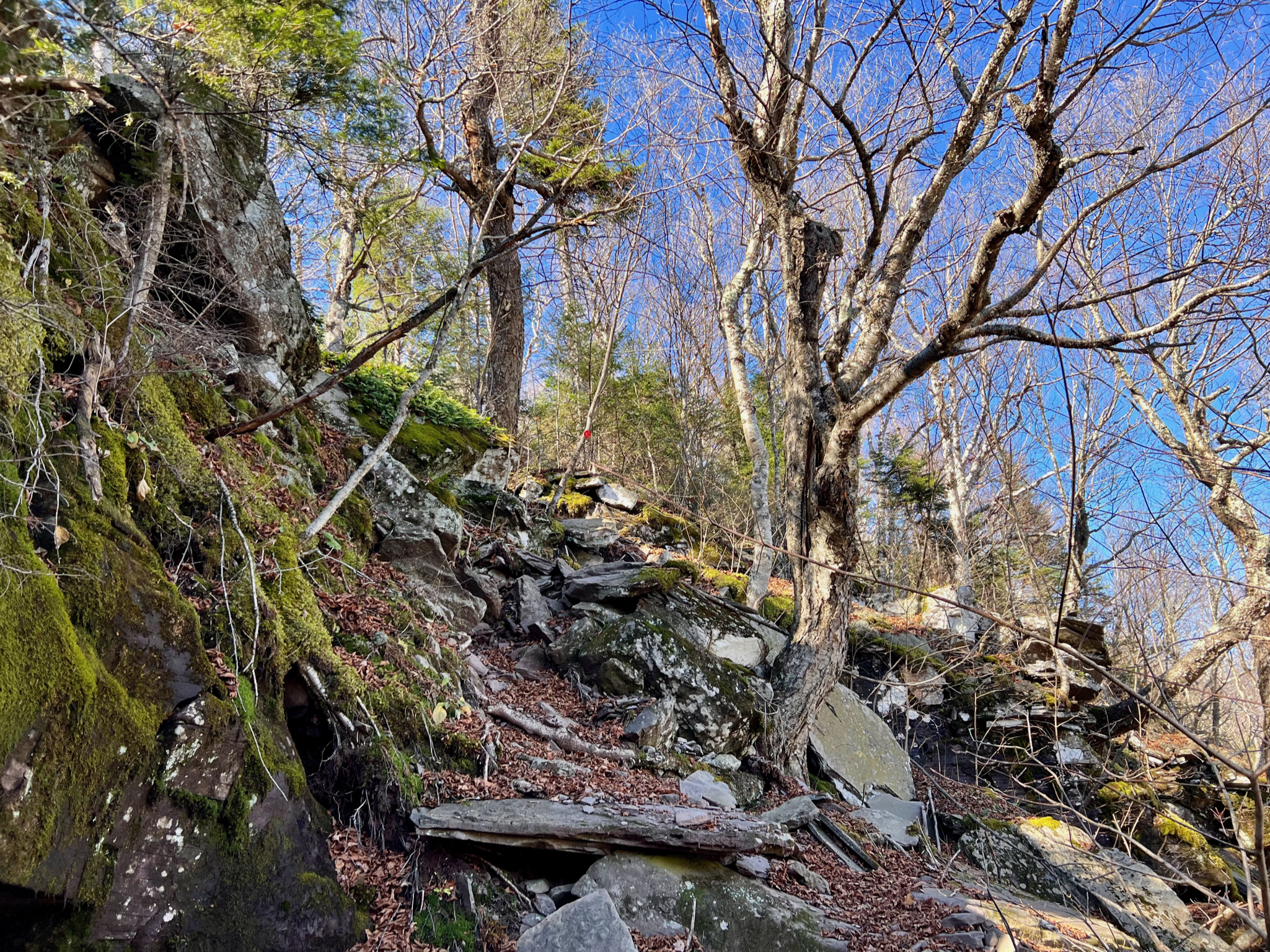
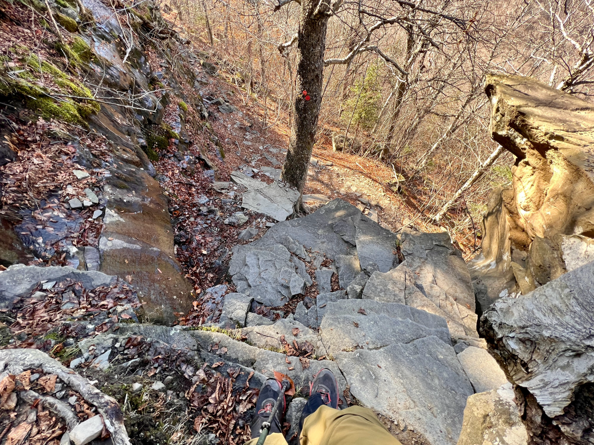
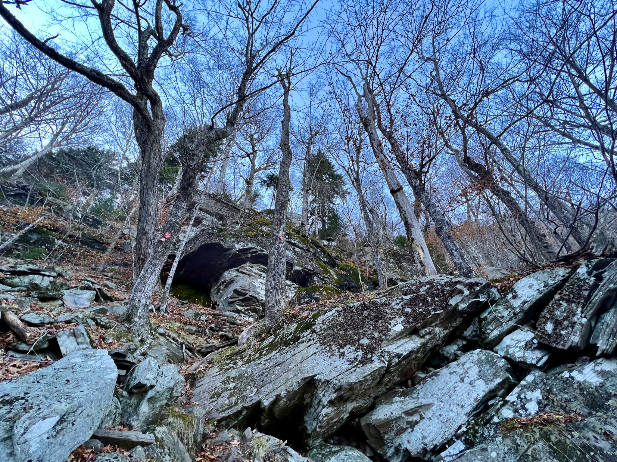
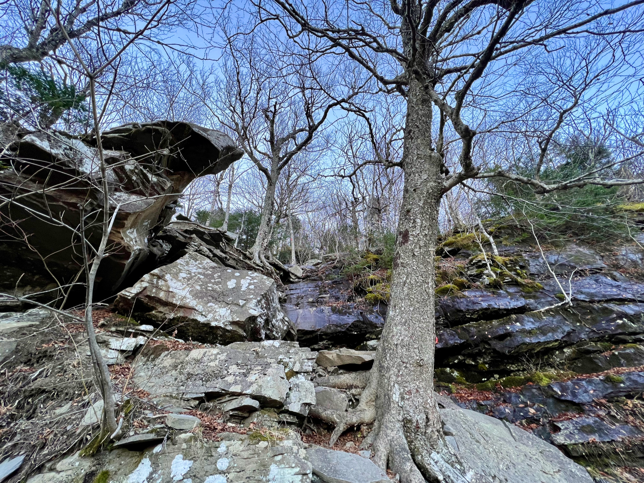
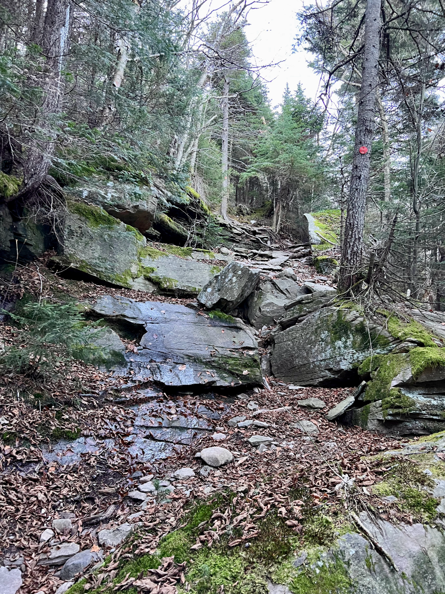
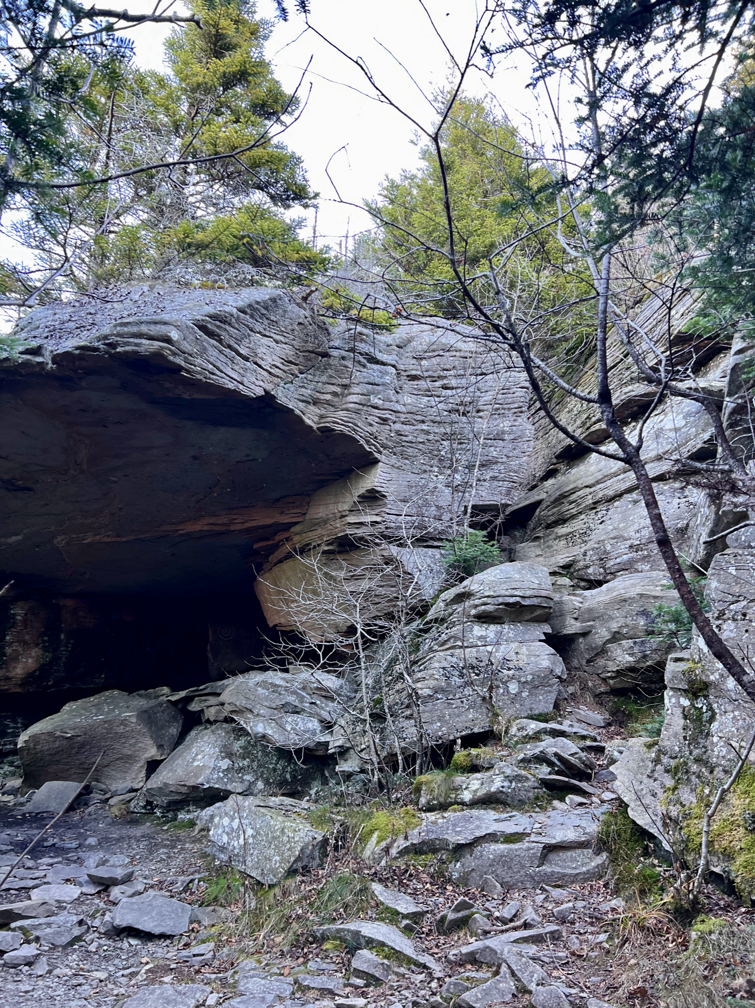
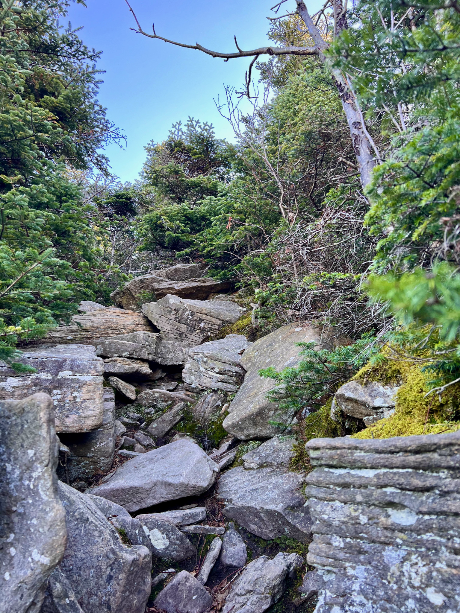
You can see on the image of my topo map below the blue route I took from Prediger Road up and over Twin, then down, then up and over Sugarloaf, then down into Mink Hollow, where I camped. It’s about 6 miles each way, with vertical gain around 2,600 feet – which isn’t much in terms of pure gain or mileage, but is challenging because much of it comprises rock scrambles, with no real navigable trail (despite trail blazes intermittently marking rock scrambles, as you’ll see in photos below).
Being at the Prediger Road trailhead brought me back to our family’s wonderful sojourn in Saugerties during July 2020. And, like my arrival at the Denning Road trailhead in September for the Cornell, Wittenberg, Slide loop that Toby and I did, I was struck and moved by that wonderful feeling that a trailhead evokes – a transition from the civilized to the wild, a gateway to the wilderness surrounding these timeless and implacable mountains.
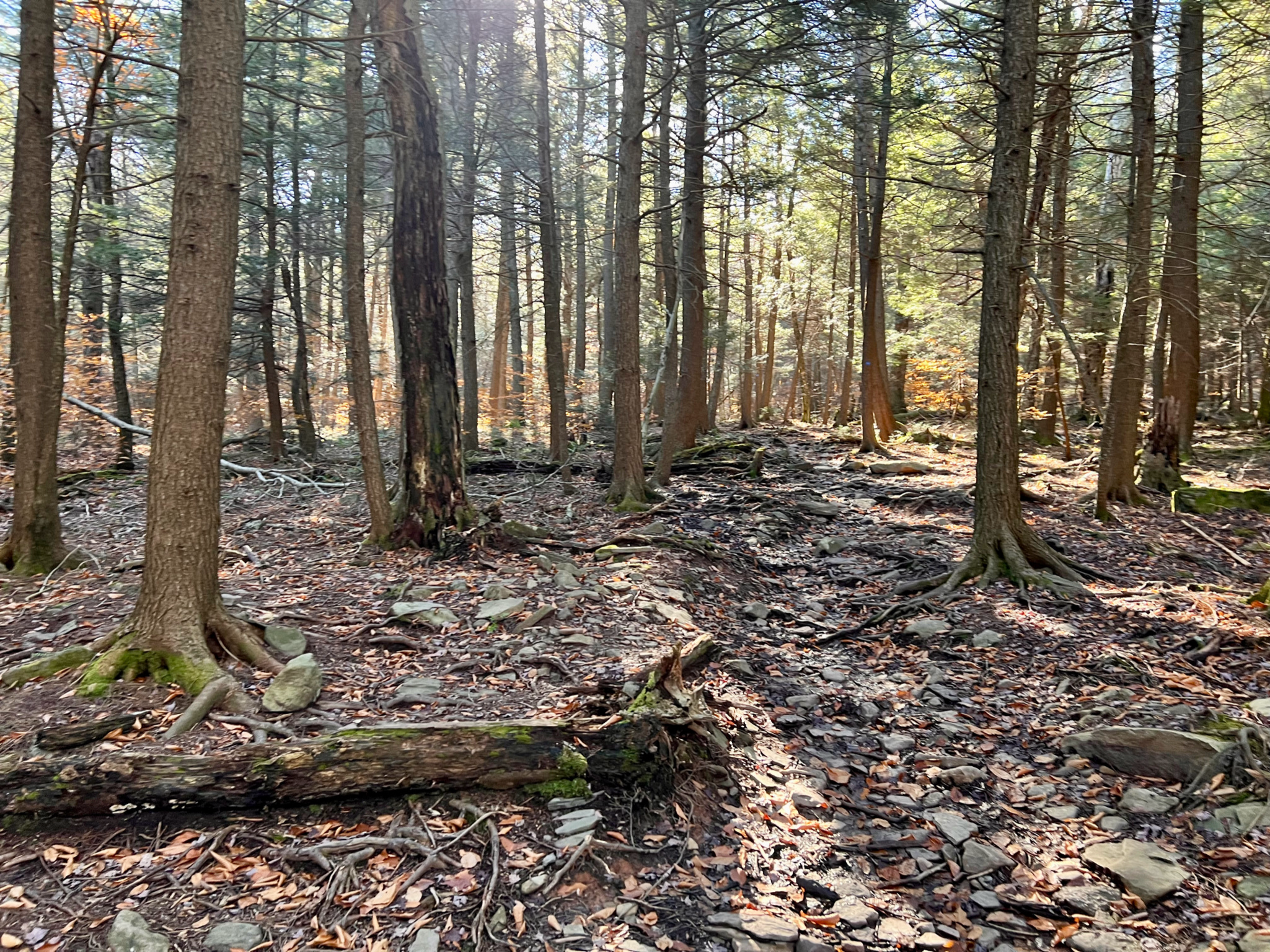
Trail
Foliage was past peak, but still lovely (though it wasn’t long before I reached tree line where few leaves remained). I was excited to sign the trail register and get going.
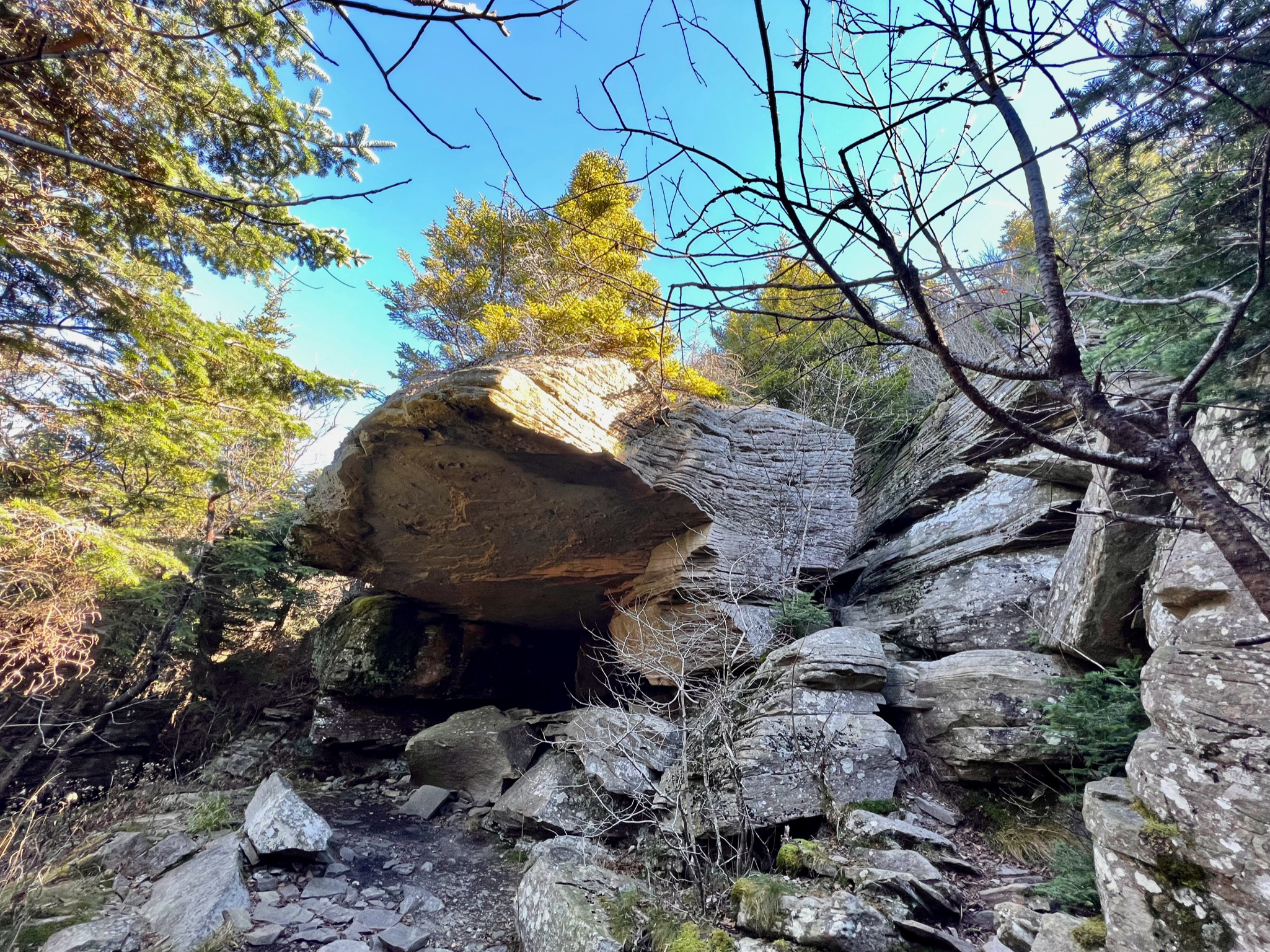
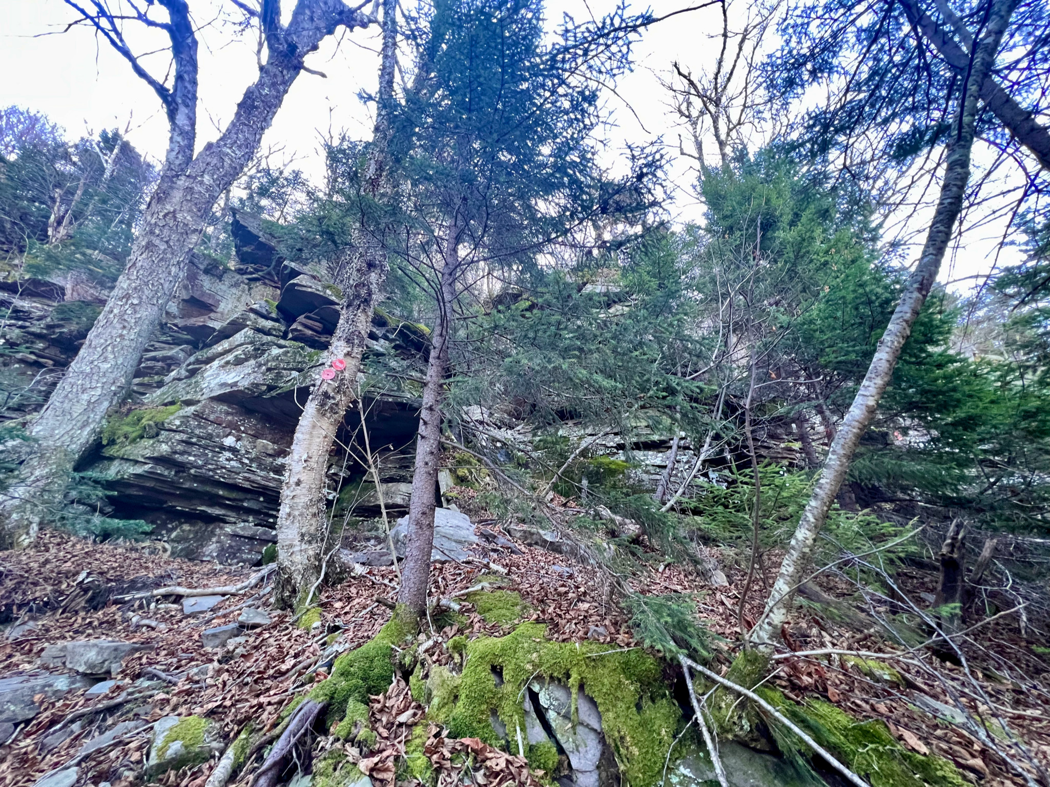
Before long the scrambling began,
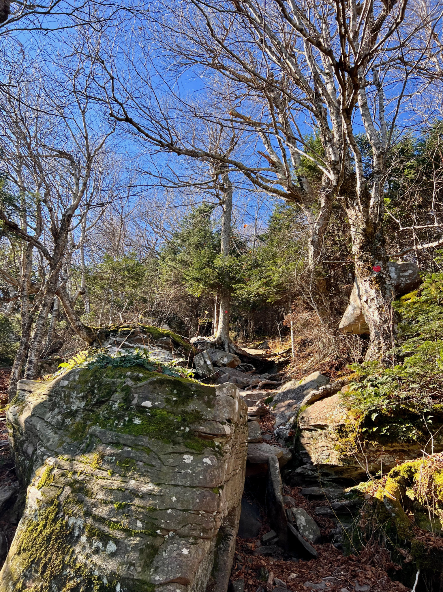
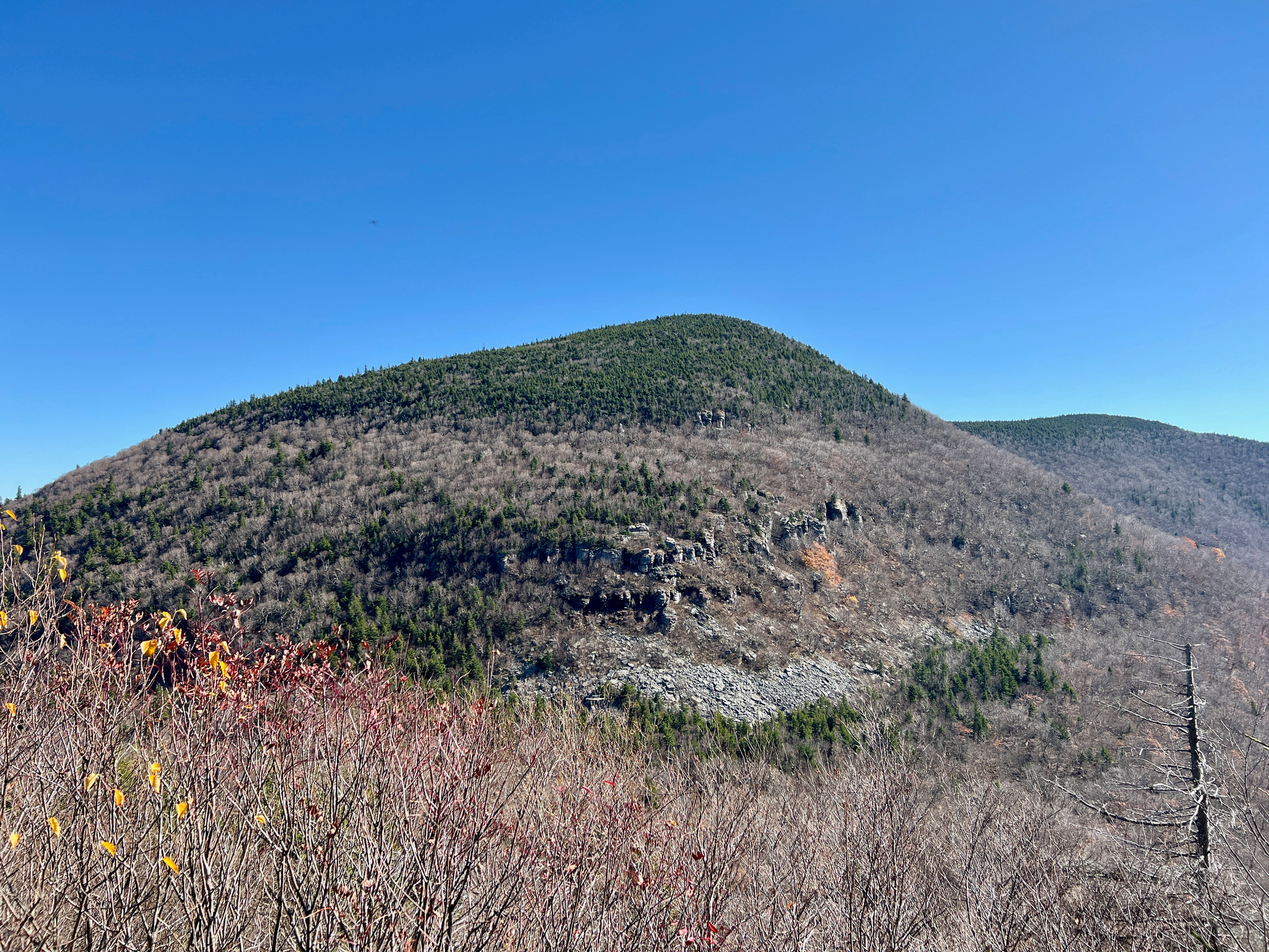
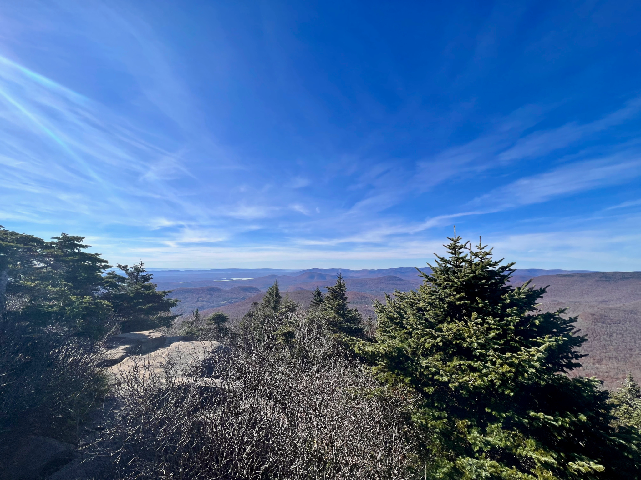
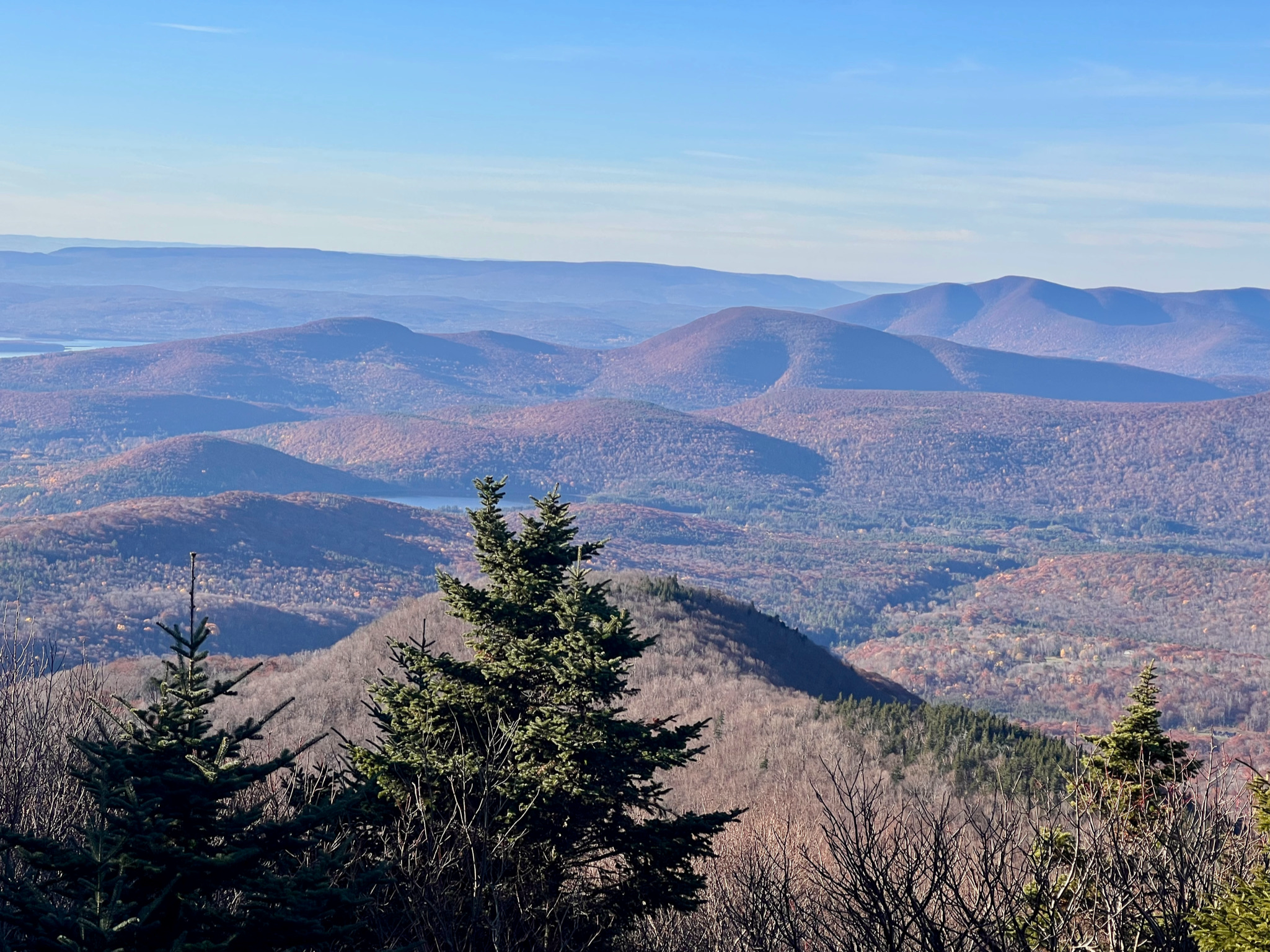
but the views – when available – were stunning.
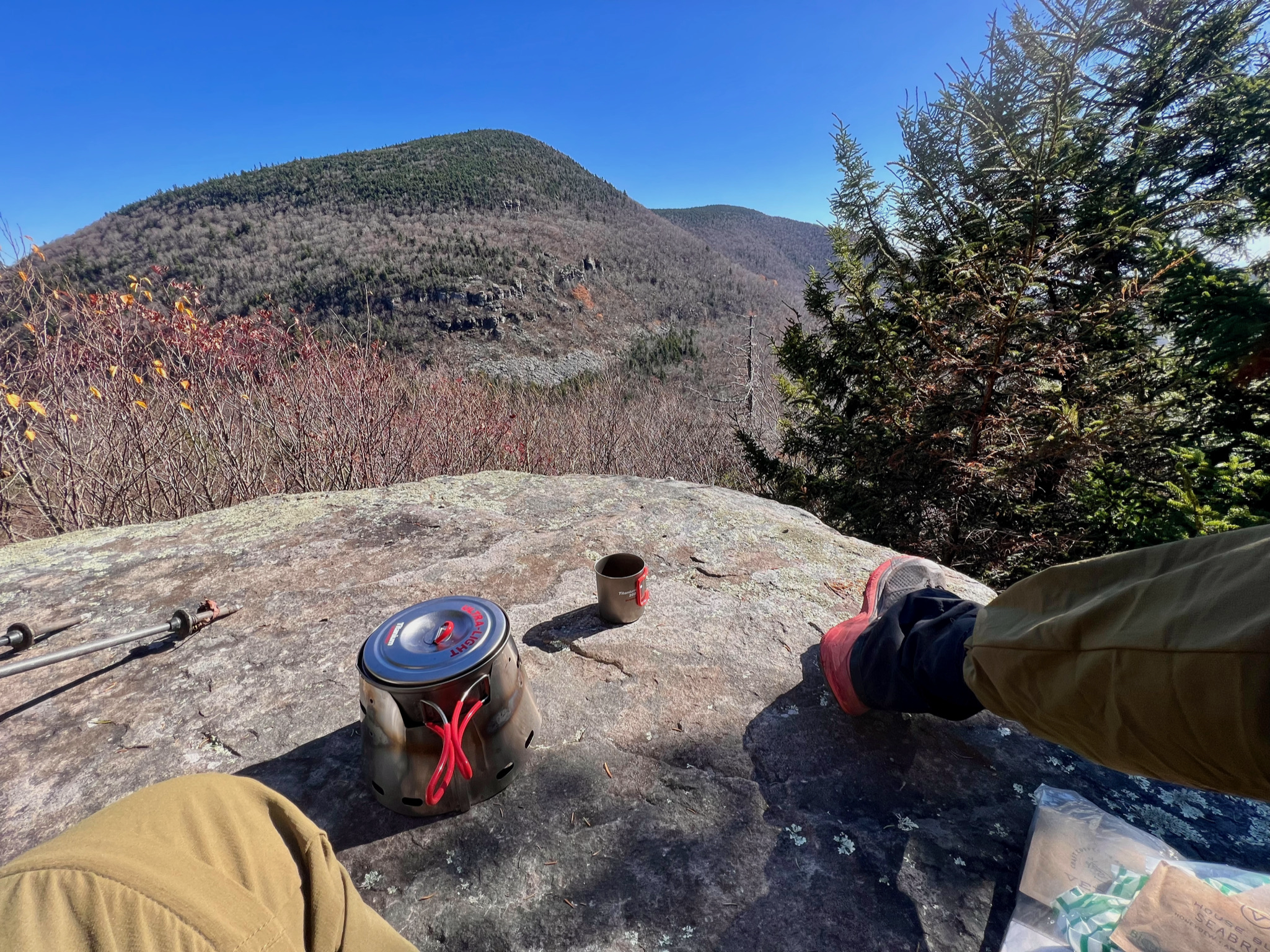
Once I began climbing Sugarloaf I reached an overlook with a great view of Twin, where I had my lunch.
And then I descended Twin before climbing Sugarloaf.
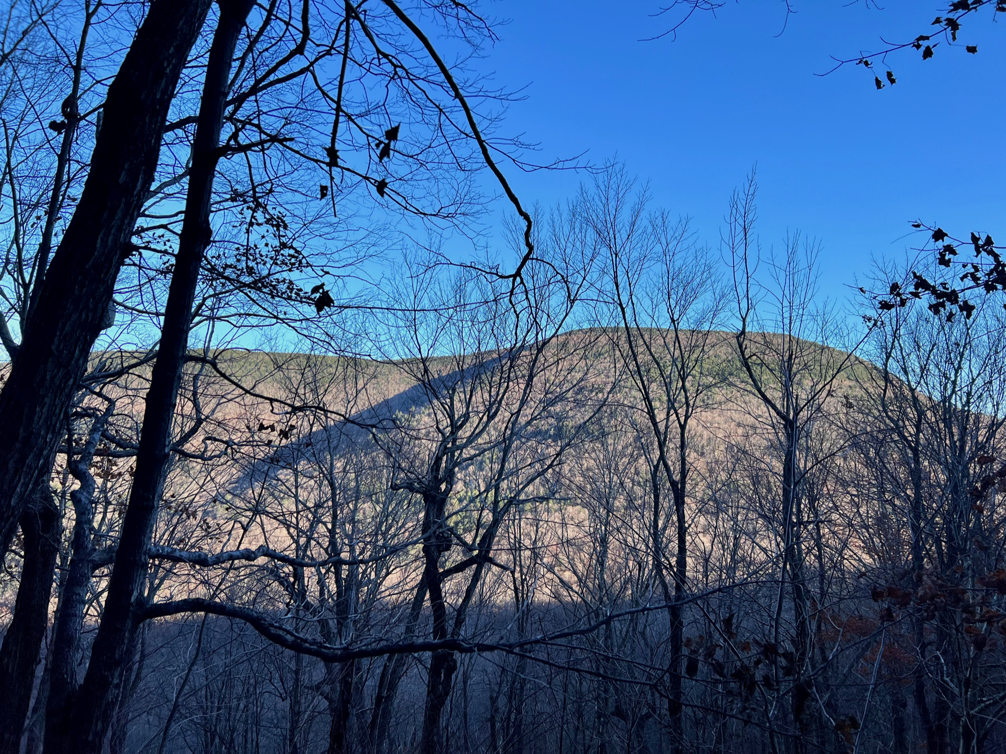
Descending into Mink Hollow the sun was already going down, casting long shadows, while still illuminating Plateau Mountain, further to the west.
Despite the activity at the trailhead parking lot when I arrived – again, mostly day hikers – there were long stretches on the trail when I saw no one. But I did spend a chunk of time descending Twin with Peter, a fit, retired, 65-year-old from Albany, who hikes on a regular basis in the Catskills, Adirondacks, White Mountains, and Green Mountains. While picking our way down the sometimes treacherous scrambles, we talked quite a bit about winter hiking techniques and gear, which he’s done a lot of (while I haven’t).
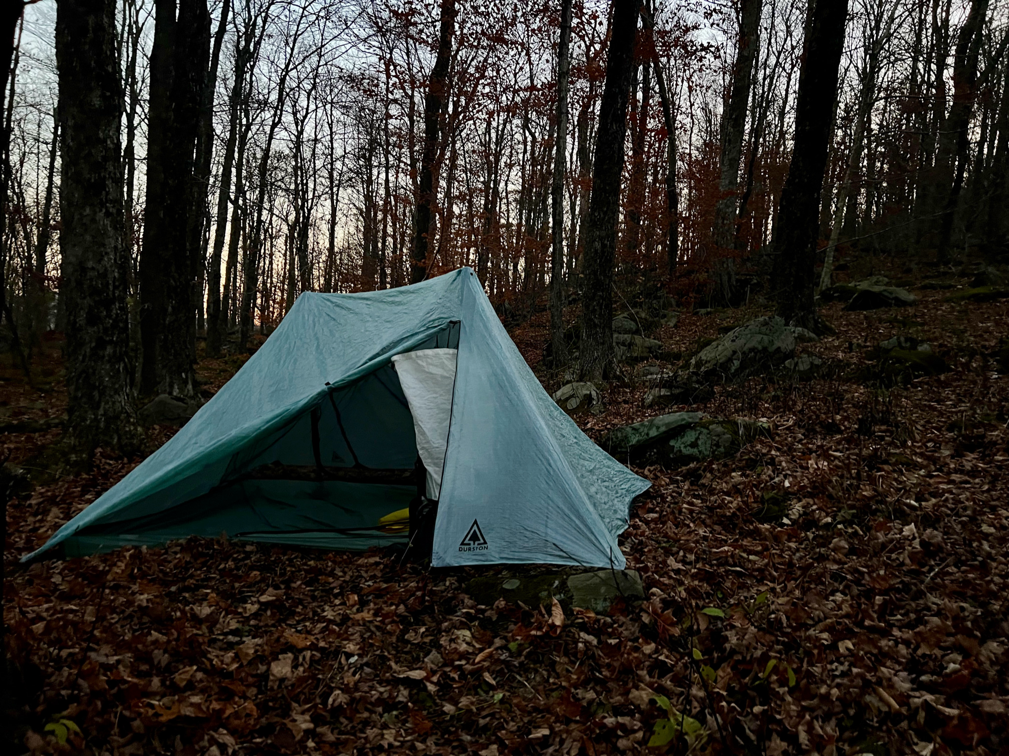
Camp
And then arriving at Mink Hollow I ran into three former University of Vermont buddies who were using the lean-to, and making a fire. I had already found a spot further away to pitch my tent, in one of the DEC’s designated “primitive” campsites – just a bit of clearing in the woods. There was a spring north of the campsite, but Carson, CJ, and Tyler also directed me to a spring on the trail up to Plateau, which was piped. I considered trying to reach the peak of Plateau while stopping to filter water, but it was another 1,200 feet of climbing, so with the sun going down before I was halfway there, I turned around and went back down to the campsite. Still, that extra partial hike up Plateau extended my mileage for the day to 7.25, with about 3,200 feet of vertical gain. The UVM guys had invited me to join them at their fire beside the lean-to, so after coming down from Plateau I sat with them and we all had dinner together.
I wish I could say I slept well, but I’m still not used to sleeping on an inflatable pad; and site selection remains a tough nut to crack: I lay down on top of my tent before pitching, to ensure the ground was level enough; but sure enough I missed a rock which changed the ultimate placement of my pad once I pitched the tent; and the pad ended up on a very subtle grade. But it was amazing to wake in the night and see the stars; and the early morning light was lovely. It was a cold night, but my quilt kept me warm enough; and I was comfortable packing up and making coffee in the morning wearing only my puffy, before getting back on the trail.
The UVM guys had planned to leave early and head west back over Plateau. But another large group supposedly arrived later (I learned this from one of their members who arrived early and joined us at the camp fire – but they didn’t camp near me) and this group would be continuing their hike of the Devil’s Path going East on Sunday, which meant they’d be heading over Sugarloaf and then Twin – the route I was taking back. So I ate a granola bar with my coffee and otherwise skipped breakfast so I could make an early start, planning on stopping later to have breakfast.
But I misjudged the severity of the trail, which on the return was even steeper – at one point I clocked 900 feet of vertical gain in less than two-thirds of a mile. And again, “trail” is a misnomer, given how much of it traversed rock scrambles, where it was necessary to use hands as well as feet.
Still, once I got to the top of Sugarloaf it was worth the view.
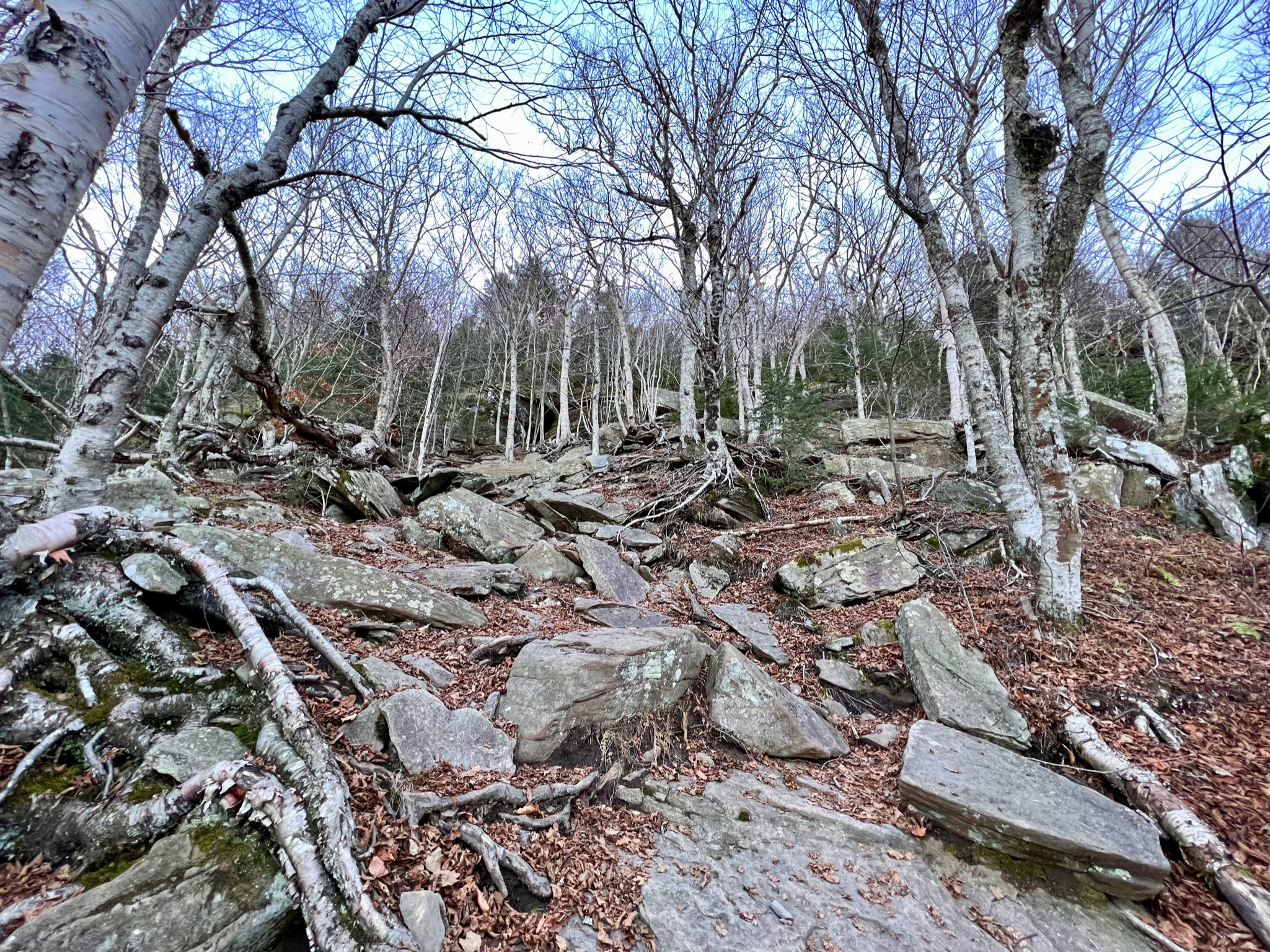
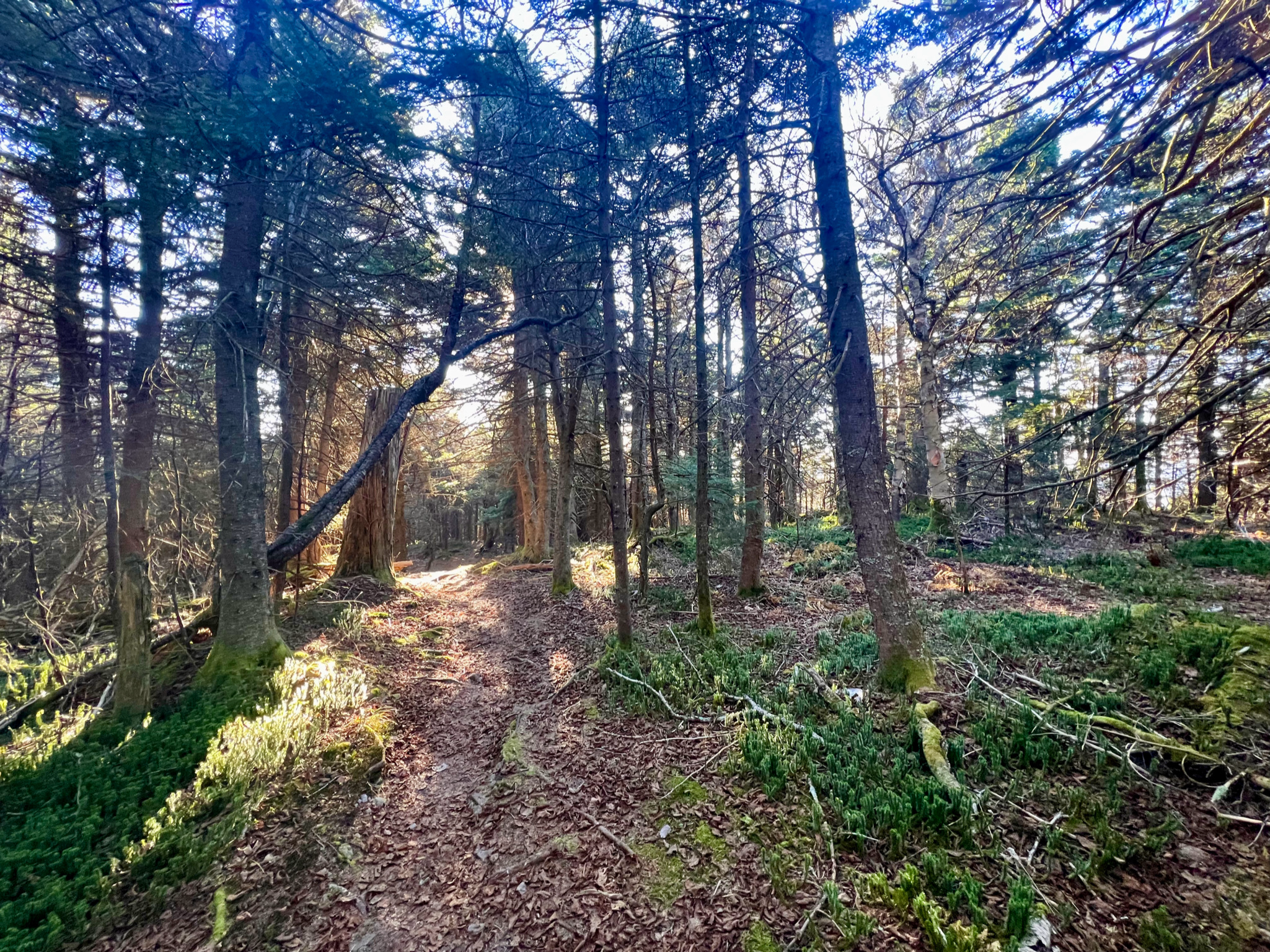
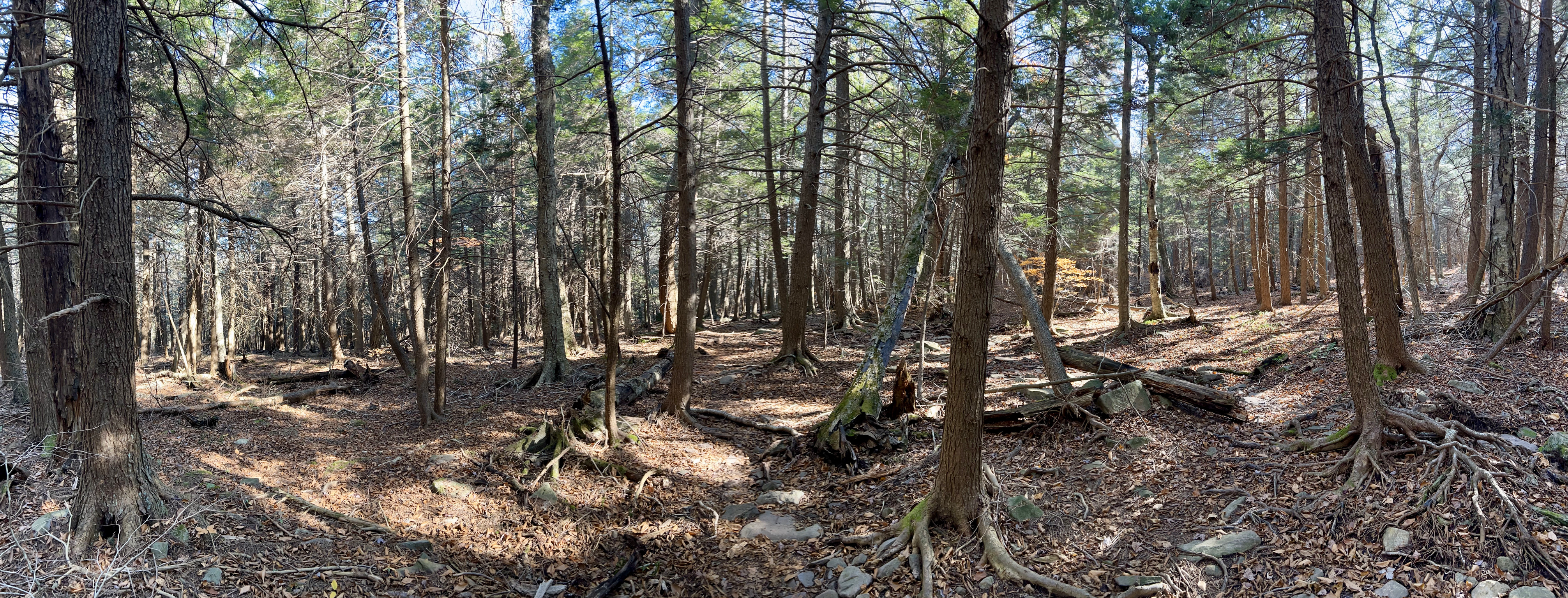
And the sub-alpine forests are beautiful.
But then you have to climb Twin again – this time, as with Sugarloaf, from the west side.
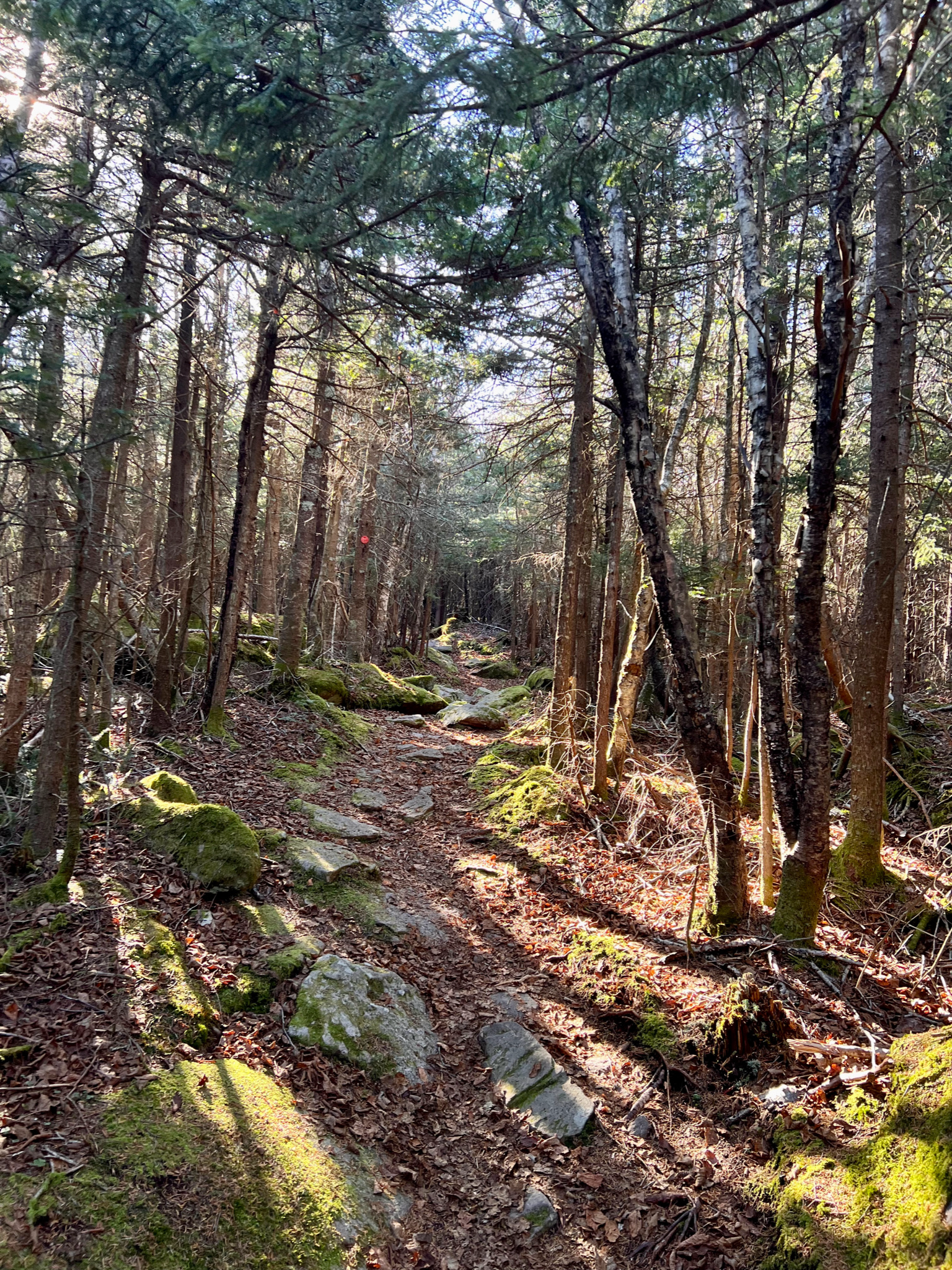
And then, having finally descended from Twin, and passed “Jimmy Dolan’s Notch”, the forest levels out somewhat, though it still remains rock and root-strewn.
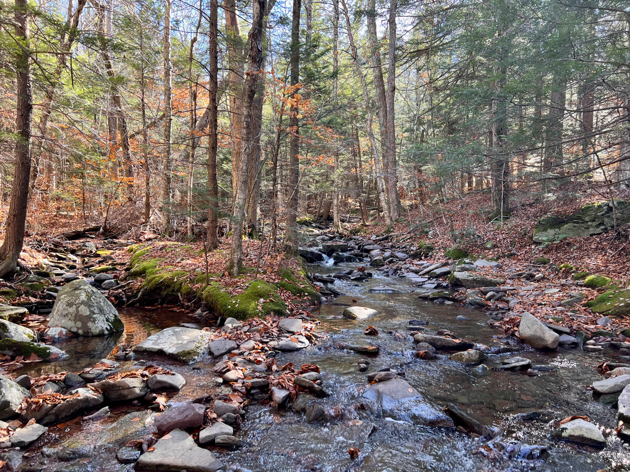
And in the lower elevations the water (blessedly) flows, with little springs, rivulets, and trickles of water. This nicely flowing stream is quite close to the trailhead, a welcome signpost of my hike’s pending completion.
Conclusion
Having hiked and camped with Toby over Labor Day weekend in the Catskills, climbing Slide, Cornell, and Wittenberg mountains, I initially didn’t think Twin and Sugarloaf were much harder. But as the up and down climbing over rocks continued, I found myself agreeing that it was simply a harder route; after all, Twin and Sugarloaf are part of the Devil’s Path (the harder part, per the literature). And as noted, my return on Sunday morning from West to East over these mountains was harder still, exacerbated by sub-optimal sleep, diminished caloric consumption (small snacks vs. a full breakfast), and some anxiety that I wouldn’t be back in NYC in time. But it was nevertheless a beautiful day; and pretty much all the hikers I met on the trail returning to the trailhead were pleasant.
With the exception of my need to refine my site selection (so important for sleep), I felt I was able to execute well on all the other backwoods skills I’ve learned (mostly from Andrew Skurka’s guided trips program, when I backpacked in the Olympics). I was tired from the trip, but not wrecked – my fitness served me well. With fuller days (or a second night), I likely could have added mileage and covered more ground. Toby and I already are considering hiking the entire Devil’s Path, which is an end-to-end route requiring a shuttle.
I missed not having Toby or Ceci with me, and missed my Olympic trip mates, but it was nice to get out alone and realize I’m comfortable camping solo. The area was so precious and beautiful, and I was grateful to have the opportunity to spend time there.

Leave a comment